
IMAGES TAKEN NEAR TO
Queen Street, CARNOUSTIE, DD7 7BB
Introduction
This page details the photographs taken nearby to Queen Street, DD7 7BB by members of the Geograph project.
The Geograph project started in 2005 with the aim of publishing, organising and preserving representative images for every square kilometre of Great Britain, Ireland and the Isle of Man.

There are currently over 7.5m images from over14,400 individuals and you can help contribute to the project by visiting https://www.geograph.org.uk
Image Map
Images are licensed for reuse under creativecommons.org/licenses/by-sa/2.0
Notes
- Clicking on the map will re-center to the selected point.
- The higher the marker number, the further away the image location is from the centre of the postcode.
Image Listing (37 Images Found)
Images are licensed for reuse under creativecommons.org/licenses/by-sa/2.0
Image
Details
Distance
1
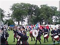
Where in the World?
The Arbroath Royal British Legion Band marching by at the 2007 Carnoustie Gala. This year's theme was 'Where in the World?' and the Band led a procession of Tractors, local youth organisations and decorated, themed 'floats' through the streets of the town and up to Carnoustie House Grounds.
Image: © Gwen and James Anderson
Taken: 7 Jul 2007
0.08 miles
2
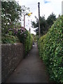
Lane, from Terrace Road to Carnoustie House Grounds.
This small lane runs to the House Grounds, which are now a park.
Image: © Gwen and James Anderson
Taken: 8 May 2007
0.12 miles
3
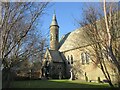
Church of the Holy Rood
Church of the Holy Rood Episcopal Church in Carnoustie, viewed from the corner of the street to the east.
Image: © Scott Cormie
Taken: 4 Jan 2022
0.12 miles
4
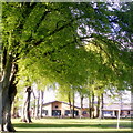
Beech trees, Carnoustie House Grounds
The park is well appointed with mature beech trees. The foliage is newly unfurled and a fresh translucent lime green. Woodlands Primary School is visible in the background. The school opened in 2007 and as part of an upgrading and replacement programme by Angus Council.
Image: © Gwen and James Anderson
Taken: 12 May 2009
0.13 miles
5
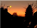
Terrace Road at Sunset
Looking west along Terrace Road.
Image: © Gwen and James Anderson
Taken: 17 Feb 2008
0.14 miles
6
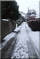
Green Lane, Carnoustie
This small lane connects Philip Street and Maule Street.
Image: © Gwen and James Anderson
Taken: 12 Feb 2009
0.16 miles
7
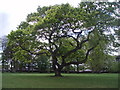
Oak tree, Carnoustie House Ground's
Or as any child who has grown up in Carnoustie will know, the climbing tree.
Image: © Gwen and James Anderson
Taken: 8 May 2007
0.16 miles
8

Close up of a garden flower
As June gets under way so do the bright summer flowers.
Image: © Gwen and James Anderson
Taken: 6 Jun 2009
0.17 miles
9
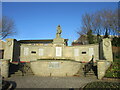
Carnoustie War Memorial
Carnoustie War Memorial on the north side of the High Street.
Image: © Scott Cormie
Taken: 4 Jan 2022
0.17 miles
10
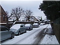
Philip Street, Carnoustie
Taken from just before the bottom Green Lane looking towards Queen Street. The southern side of the street is largely occupied by large victorian villas. The north side is again mainly victorian but the houses are of slightly smaller proportions.
A new build house can be seen partly obscured behind the tree in the centre. This represents a growing trend to subdivide the gardens of older properties for housing. The large roof behind this building is an engineering business an example of mixed residential and industrial land use.
Image: © Gwen and James Anderson
Taken: 12 Feb 2009
0.17 miles