IMAGES TAKEN NEAR TO
Church Street, DUNDEE, DD5 1EZ

Introduction

This page details the photographs taken nearby to Church Street, DD5 1EZ by members of the Geograph project.

The Geograph project started in 2005 with the aim of publishing, organising and preserving representative images for every square kilometre of Great Britain, Ireland and the Isle of Man.

There are currently over 7.5m images from over14,400 individuals and you can help contribute to the project by visiting https://www.geograph.org.uk

Image Map


Images are licensed for reuse under creativecommons.org/licenses/by-sa/2.0
Notes
  • Clicking on the map will re-center to the selected point.
  • The higher the marker number, the further away the image location is from the centre of the postcode.

Image Listing (125 Images Found)

Images are licensed for reuse under creativecommons.org/licenses/by-sa/2.0
  • ...
Image
Details
Distance
1
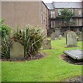
Old burial ground
Completely surrounded by buildings this was formerly the Broughty Ferry burial ground. It was officially closed in 1867, as a result of an outbreak of cholera, although interments did continue here for some time, despite the ban.
Image: © James Allan Taken: 25 Jan 2016
0.02 miles
2
The Old Burial Ground Broughty Ferry
The Old Burial Ground is hidden from view by surrounding properties. It is the site of the pre-Reformation Chaplainrie of Broughty which was abandoned circ 1670. A morthouse remains intact at south east corner.
Image: © Douglas Nelson Taken: 23 Jul 2012
0.02 miles
3
Morthouse at Old Burial Ground Broughty Ferry
See Image
Image: © Douglas Nelson Taken: 23 Jul 2012
0.03 miles
4
Information plaque near Old Burial Ground
Sited in Fisher Street, Broughty Ferry See Image
Image: © Douglas Nelson Taken: 23 Jul 2012
0.03 miles
5
Footpath/cycle path: Broughty Ferry
Recent addition as shown by Streetview (June 2018)
Image: © Jim Smillie Taken: 29 Oct 2022
0.03 miles
6
Douglas Terrace
Image: © Richard Webb Taken: 23 Feb 2013
0.04 miles
7
James Place
James Place is part of the promenade which extends all along the seaward side of Broughty Ferry. In the 19th century it was the main road along the coast, superseded first by what is now the A930 to the north, and then by what is now the A92 trunk road still further north, leaving it as a peaceful area to stroll along and admire the Tay estuary.
Image: © Anne Burgess Taken: 29 Jun 2011
0.04 miles
8
Promenade at James Place, Broughty Ferry
Image: © Oliver Dixon Taken: 20 Aug 2022
0.04 miles
9
James Place, Broughty Ferry
Image: © JThomas Taken: 23 Oct 2013
0.04 miles
10
Housing at Dundas Street, Broughty Ferry
Awarded a commendation in the Saltire Society Housing Awards in 1989. Designed by The Parr Partnership.
Image: © Graeme Yuill Taken: 19 Oct 2017
0.04 miles
  • ...