IMAGES TAKEN NEAR TO
Whitfield Terrace, DUNDEE, DD4 0BR
Introduction
This page details the photographs taken nearby to Whitfield Terrace, DD4 0BR by members of the Geograph project.
The Geograph project started in 2005 with the aim of publishing, organising and preserving representative images for every square kilometre of Great Britain, Ireland and the Isle of Man.

There are currently over 7.5m images from over14,400 individuals and you can help contribute to the project by visiting https://www.geograph.org.uk
Image Map
Images are licensed for reuse under creativecommons.org/licenses/by-sa/2.0
Notes
- Clicking on the map will re-center to the selected point.
- The higher the marker number, the further away the image location is from the centre of the postcode.
Image Listing (11 Images Found)
Images are licensed for reuse under creativecommons.org/licenses/by-sa/2.0
Image
Details
Distance
2
Pedestrian entrance, St Saviour's High School
The school merged with Lawside Academy to form St Paul's Academy. The buildings were demolished.
Image: © Richard Webb
Taken: 8 Oct 2013
0.12 miles
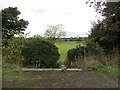
4
Site of St Saviour's High School
The school merged with Lawside Academy and the buildings later demolished.
Image: © Richard Webb
Taken: 8 Oct 2013
0.16 miles
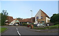
5
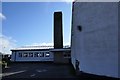
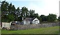
Whitfield Parish Church
Built in 1970 Whitfield Parish Church has been serving the community for 50 years. The church is the base for many community led activities.
Image: © Mary Rodgers
Taken: 25 Feb 2020
0.17 miles
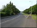
6
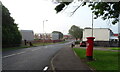
Whitfield Drive, Dundee
Showing position of Postbox No. DD4 284.
See Image] for postbox.
Image: © JThomas
Taken: 20 Jul 2021
0.20 miles
7
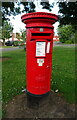
Elizabethan postbox on Whitfield Drive, Dundee
Postbox No. DD4 284.
See Image] for context.
Image: © JThomas
Taken: 20 Jul 2021
0.21 miles
8
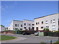
Whitfield, Dundee
Whitfield, which dates from the 1970s was the last big post war housing estate built by the local authority in Dundee.
Image: © Val Vannet
Taken: 15 May 2005
0.22 miles
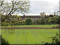
10
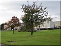
Whitfield
A 1970s housing scheme, now largely missing, presumed demolished from modern Ordnance Survey maps.
Image: © Richard Webb
Taken: 8 Oct 2013
0.23 miles