IMAGES TAKEN NEAR TO
Keats Place, DUNDEE, DD3 6QH

Introduction

This page details the photographs taken nearby to Keats Place, DD3 6QH by members of the Geograph project.

The Geograph project started in 2005 with the aim of publishing, organising and preserving representative images for every square kilometre of Great Britain, Ireland and the Isle of Man.

There are currently over 7.5m images from over14,400 individuals and you can help contribute to the project by visiting https://www.geograph.org.uk

Image Map


Images are licensed for reuse under creativecommons.org/licenses/by-sa/2.0
Notes
  • Clicking on the map will re-center to the selected point.
  • The higher the marker number, the further away the image location is from the centre of the postcode.

Image Listing (77 Images Found)

Images are licensed for reuse under creativecommons.org/licenses/by-sa/2.0
  • ...
Image
Details
Distance
1
Tay Rail bridge
Viewed from the top of Dundee Law, the Tay rail bridge is silhouetted against the sparkling waters of the River Tay. The bridge was opened in 1887, eight years after the collapse of the first rail bridge in a winter storm. http://www.railscot.co.uk/Tay_Bridge_and_associated_lines/body.htm
Image: © Val Vannet Taken: 8 Feb 2004
0.03 miles
2
View north west from Dundee Law
Few cities in Britain have such a splendid central vantage point as Dundee. This and other photos uploaded for this square are taken from Dundee Law and give a 360 degree panorama from its summit. This view looks north west across the outer city suburbs towards the Sidlaw Hills in the distance.
Image: © Val Vannet Taken: 31 Oct 2004
0.03 miles
3
View west from Dundee Law
This view from Dundee looking west is dominated by the Lochee multis in the middle distance. The Sidlaw Hills are on the skyline
Image: © Val Vannet Taken: 31 Oct 2004
0.03 miles
4
Fog in the Tay estuary
This view south from the summit of Dundee law shows a temperature inversion in the river estuary. Normally it is possible to see across the river to Fife. On this June morning cold air had crept from the sea into the river mouth (not an uncommon event especially in summer when sea haar spoils many a fine day in Dundee) and only a tiny fragment of Fife is visible above it.
Image: © Val Vannet Taken: 22 Jun 2004
0.03 miles
5
The Tay Rail Bridge as seen from Dundee Law
The Wikipedia article contains interesting photos and information on the bridge. http://en.wikipedia.org/wiki/Tay_rail_bridge
Image: © Gwen and James Anderson Taken: 26 Mar 2009
0.03 miles
6
Factories and tenements in Dundee's inner city
Another view from the top of Dundee Law, this time to the north east. In the foreground are 19th century jute factories and tenements and beyond this the view stretches to the 20th century suburbs and open countryside.
Image: © Val Vannet Taken: 30 May 2004
0.03 miles
7
Midsummer night!
Not dissimilar to another view already uploaded for this square - except this one is taken at 10.30pm! It is testimony to the long hours of daylight in summer in 'high latitudes'. The view extends as far as St Andrews bay and the coast of Fife in the distance.
Image: © Val Vannet Taken: 21 Jun 2004
0.03 miles
8
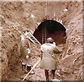
Prior to building houses near this site, the old Law railway tunnel was uncovered and surveyed.
Image: © Elliott Simpson Taken: Unknown
0.03 miles
9
Old Water Tower on the easy slope of the Dundee Law
Image: © Elliott Simpson Taken: Unknown
0.12 miles
10
Water tower on lower slopes of Dundee Law
Image: © Douglas Nelson Taken: 28 Apr 2016
0.12 miles
  • ...