Fog in the Tay estuary
Introduction
The photograph on this page of Fog in the Tay estuary by Val Vannet as part of the Geograph project.
The Geograph project started in 2005 with the aim of publishing, organising and preserving representative images for every square kilometre of Great Britain, Ireland and the Isle of Man.

There are currently over 7.5m images from over 14,400 individuals and you can help contribute to the project by visiting https://www.geograph.org.uk
Fog in the Tay estuary
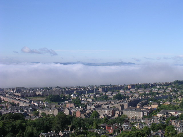
Image: © Val Vannet Taken: 22 Jun 2004
This view south from the summit of Dundee law shows a temperature inversion in the river estuary. Normally it is possible to see across the river to Fife. On this June morning cold air had crept from the sea into the river mouth (not an uncommon event especially in summer when sea haar spoils many a fine day in Dundee) and only a tiny fragment of Fife is visible above it.
Images are licensed for reuse under creativecommons.org/licenses/by-sa/2.0
Image Location


Leaflet Map data © OpenStreetMap
Latitude
56.471723
Longitude
-2.983638