
IMAGES TAKEN NEAR TO
Southesk Court, MONTROSE, DD10 9SW
Introduction
This page details the photographs taken nearby to Southesk Court, DD10 9SW by members of the Geograph project.
The Geograph project started in 2005 with the aim of publishing, organising and preserving representative images for every square kilometre of Great Britain, Ireland and the Isle of Man.

There are currently over 7.5m images from over14,400 individuals and you can help contribute to the project by visiting https://www.geograph.org.uk
Image Map
Images are licensed for reuse under creativecommons.org/licenses/by-sa/2.0
Notes
- Clicking on the map will re-center to the selected point.
- The higher the marker number, the further away the image location is from the centre of the postcode.
Image Listing (84 Images Found)
Images are licensed for reuse under creativecommons.org/licenses/by-sa/2.0
Image
Details
Distance
1
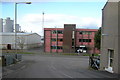
Usan Road, Ferryden approaching its junction with Southesk Place and Brownlow Place
Looking north.
Image: © Alan Morrison
Taken: 10 Mar 2009
0.02 miles
2
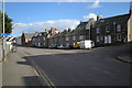
Southesk Place, Ferryden at its junction with Brownlow Place and Usan road
Picture taken from Southesk Place. Usan road is to the right.
Image: © Alan Morrison
Taken: 10 Mar 2009
0.04 miles
3
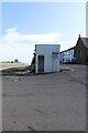
Robert Burns plaque on Ferryden Pier, Angus
As part of the Robert Burns Trail in the Montrose area, a plaque has been fixed to the west-southwest facing wall of the public convenience on the pier. Under the heading of Ferryden Pier, the plaque reads:
‘After spending the night at the Turks Head Inn on the 12th Sept 1787, Robert Burns left Montrose with his travelling companion William Nicol, to continue his journey South to Auchmithie where they were to have breakfast.
At that time, there was no bridge over the South Esk river and it is believed that Burns took the ferry boat from Montrose over to Ferryden and he would have landed at the pier. The pier still exists today, similar to what it would have been back then. Although there is no longer a ferry boat the pier is still used by the local community.’
O’er the Water to Charlie – Robert Burns
Come boat me o’er, come row me oe’r,
Come boat me o’er to Charlie.
I’ll gie John Ross anither bawbee,
To boat me oe’r to Charlie.
https://www.geograph.org.uk/photo/7910302
Image: © Adrian Diack
Taken: 22 Aug 2024
0.04 miles
4
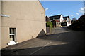
View of Usan Road, Ferryden
Picture taken from its junction with Brownlow Place and Southesk Place, looking south.
Image: © Alan Morrison
Taken: 10 Mar 2009
0.05 miles
5
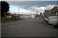
View of Brownlow Place, Ferryden
Picture taken from its junction with Usan Road, looking east.
Image: © Alan Morrison
Taken: 10 Mar 2009
0.06 miles
6
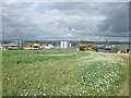
Northerly view of pea field by Ferryden
This photo shows a northerly view of a pea field near Ferryden with Montrose in the distance.
Image: © Adrian Diack
Taken: 27 Jul 2017
0.06 miles
7

Prime Minister Margaret Thatcher named Inchcape Quay, Ferryden
The use of the old pier at Ferryden, in Angus, is divided between the local community on the eastern half and Seagreen to the west, with the photo being taken from the side that is in community use, principally by Usan Fisheries. It is somewhat unusual to take a photo through a meshed fence, but it is rewarding in that the view encompasses many aspects of the long history of Montrose. In the distance to the northwest by the white building is the area of Stromnay, where the Vikings had a port from around 980 AD. Close to that is the new bridge of 2004, which was floated up the estuary and through the port area of Montrose. Another notable event that took place in the area of Montrose and Ferryden was a sea battle involving two French ships, two Royal Navy ships and a number of merchant ships that were in the harbour. The second Jacobite rebellion began on August 17th, 1745, and soon after, on November 11th, 1745, the arrival of HMS Hazard in Montrose proved to be the catalyst that triggered the largest naval battle of those times. HMS Hazard was a sloop with sixteen heavy guns, twenty-four swivel guns and a crew of over eighty men that weighed anchor off Ferryden, but because no message was sent from the town, Captain Hill erroneously assumed Montrose to be a hostile port, and he bombarded it in a relentless way for a period of three days. The bombardment caused considerable damage to buildings, injuries and loss of life. This action set in motion a train of events that resulted in the unrigging and burning of ships in Montrose harbour, the sinking of the French ship ‘La Fine’ by HMS Milford and the capture of HMS Hazard by Jacobite forces on the 24th of November 1745. HMS Hazard was fired upon by cannons positioned at Horeloge Hill in the area of Stromnay while also being fired on by other cannons from the point of Rossie Island by a force of 150 men of Lord John Drummond’s Regiment aided by some Irish Jacobites. A party of French sharpshooters positioned on the high ground above Ferryden formed another group of encircling attackers, and the combined efforts of the Jacobites and their allies forced the beleaguered ship to raise the white flag. HMS Hazard was renamed “Le Prince Charles Stuart” and sailed to France for a refit and to take on a cargo of gold and munitions to further aid the Jacobite cause.
In more recent times, the multi-million-pound marine base of Sea Oil Services at Ferryden was opened by Lord Inchcape, Chairman of the P&O Group, on April 25, 1975. Beyond the meshed fence, the photo shows part of Seagreen’s wind energy offices, part of the communications mast and Inchcape Quay that extends toward Jack Smith Quay. The multi-million pound marine base of Sea Oil Services at Ferryden was opened by Lord Inchcape, Chairman of the P&O Group, on April 25, 1975. Shortly after this, on the 16th of May 1975, the Rt Hon. Margaret Thatcher, the then Prime Minister, entered this waterfront area from Ferryden Pier in order to name the newly constructed quays and to declare them open. Prior to the opening, she was invited on board the Star Taurus, a brand new vessel costing about £2,000,000 and owned by Star Offshore Services Ltd. The trip took her down the estuary and beyond the Annat Bank, where, in a demonstration of her manoeuvrability, the ship was put through her paces. Back onshore Mrs Thatcher named Inchcape Quay, Jack Smith Quay, Captain Gordon Graham Quay (the harbourmaster) and Nicoll’s Knuckle, which joins Inchcape Quay to the old Ferryden Pier. Mrs Thatcher said that Montrose had a great and very proud record of the past, but it had also learned to look to the future.”
Image: © Adrian Diack
Taken: 22 Jul 2024
0.06 miles
8
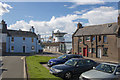
View from the car park in Rossie Square towards Montrose Harbour
This photo was taken by the car park in Rossie Square, Ferryden, and it looks toward ships berthed in Montrose Harbour.
Image: © Andrew Diack
Taken: 16 Aug 2018
0.06 miles
9
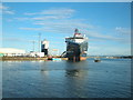
Ship berthed at Rossie Island
This photo shows a ship moored at Rossie Island. Since the completion of the infilling of the Inch Burn channel in 1972, Rossie Island has been a peninsula.
Image: © Adrian Diack
Taken: 25 Jul 2016
0.06 miles
10
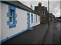
Southesk Place, Ferryden
The residential side of the street facing the docks and associated industrial buildings to the north.
Image: © Richard Webb
Taken: 21 Sep 2009
0.07 miles