IMAGES TAKEN NEAR TO
MONTROSE, DD10 9LF
Introduction
This page details the photographs taken nearby to DD10 9LF by members of the Geograph project.
The Geograph project started in 2005 with the aim of publishing, organising and preserving representative images for every square kilometre of Great Britain, Ireland and the Isle of Man.

There are currently over 7.5m images from over14,400 individuals and you can help contribute to the project by visiting https://www.geograph.org.uk
Image Map
Images are licensed for reuse under creativecommons.org/licenses/by-sa/2.0
Notes
- Clicking on the map will re-center to the selected point.
- The higher the marker number, the further away the image location is from the centre of the postcode.
Image Listing (10 Images Found)
Images are licensed for reuse under creativecommons.org/licenses/by-sa/2.0
Image
Details
Distance
1
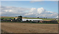
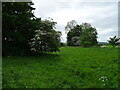
Pugeston Farm
The farm is dwarfed by the large modern barn.
Image: © Anne Burgess
Taken: 27 Aug 2013
0.04 miles
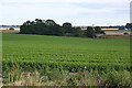
2
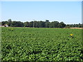
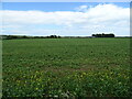
Potato field with sunflowers
Potato field near Pugeston, with the occasional sunflower in view.
Image: © Scott Cormie
Taken: 8 Sep 2018
0.09 miles
3
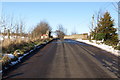
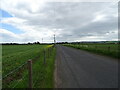
Bridge over the Dismantled Railway near Pugeston
Photo taken from Newbigging / Kirkhill Road, looking northwards.
Image: © Alan Morrison
Taken: 13 Feb 2009
0.09 miles
4
View of Dismantled Railway near Pugeston
Photo taken from Bridge on Newbigging / Kirkhill Road, looking NE.
Image: © Alan Morrison
Taken: 13 Feb 2009
0.11 miles
8
View of Dismantled Railway near Pugeston
Photo taken from the Bridge on the Newbigging / Kirkhill Road, looking SW
Image: © Alan Morrison
Taken: 13 Feb 2009
0.19 miles
9
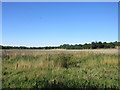
Fields near Wellhill
Scrubland with potato fields beyond, to the west of Wellhill.
Image: © Scott Cormie
Taken: 8 Sep 2018
0.20 miles
10
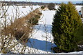
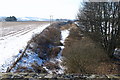
Fields by the old Railway
The trees at the far side of this field mark the line of the disused railway between Brechin and Montrose, which crosses the field drain by a bridge just to the right of the trees.
Image: © Anne Burgess
Taken: 27 Aug 2013
0.23 miles