IMAGES TAKEN NEAR TO
Christies Lane, MONTROSE, DD10 8HY

Introduction

This page details the photographs taken nearby to Christies Lane, DD10 8HY by members of the Geograph project.

The Geograph project started in 2005 with the aim of publishing, organising and preserving representative images for every square kilometre of Great Britain, Ireland and the Isle of Man.

There are currently over 7.5m images from over14,400 individuals and you can help contribute to the project by visiting https://www.geograph.org.uk

Image Map


Images are licensed for reuse under creativecommons.org/licenses/by-sa/2.0
Notes
  • Clicking on the map will re-center to the selected point.
  • The higher the marker number, the further away the image location is from the centre of the postcode.

Image Listing (111 Images Found)

Images are licensed for reuse under creativecommons.org/licenses/by-sa/2.0
  • ...
Image
Details
Distance
1
30-31 Christie's Lane
This interesting property displays a feature typical of many in Montrose in the gabled chimney stack of the front elevation. The datestone above the front door reads 1885 and the property is listed, category C(S), with details at: http://www.britishlistedbuildings.co.uk/sc-46177-30-and-31-christie-s-lane-including-bound#.V4CxcTU5t8E
Image: © Michael Dibb Taken: 13 Jun 2016
0.01 miles
2
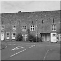
Chapel Works, Montrose
19th century textile mill converted for residential use, managed by Caledonian Housing Association and providing accommodation for older people.
Image: © Leslie Barrie Taken: 6 Apr 2013
0.05 miles
3
William Rodger Drive
A residential conversion of a former flax mill and workhouse.
Image: © Richard Webb Taken: 22 Jul 2024
0.08 miles
4
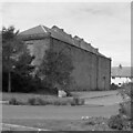
Chapel Works
One of two surviving parts of the circa 1850 flax mill complex that once occupied all the site from here to Eastern Road. This was a warehouse where the flax was stored. Listed, category B, with details at: http://www.britishlistedbuildings.co.uk/sc-38214-eastern-road-and-paton-s-lane-chapel-work#.V4CssjU5t8E There are more details and history on the buildings at risk register: http://www.buildingsatrisk.org.uk/details/910178
Image: © Michael Dibb Taken: 13 Jun 2016
0.08 miles
5
Warehouse, Montrose
Not sure what the modern use of this forbidding building is, it was a warehouse for the Chapel Works, a flax mill.
Image: © Richard Webb Taken: 22 Jul 2024
0.08 miles
6
Montrose at dusk
A beautiful view of the town at dusk. Taken from the dunes at the campsite. The spire of Old and St Andrew's Church is the first thing you see as you head to the town from any direction.
Image: © Dona Robbins Taken: 16 Apr 2010
0.08 miles
7
Paton's Lane, Montrose at its junction with Eastern Road
Image: © Alan Morrison Taken: 30 Aug 2007
0.10 miles
8
Wood Pigeons at Montrose
Image: © Ann Harrison Taken: 11 May 2009
0.11 miles
9
Marine Avenue, Montrose
Heading east from its junction with Eastern Road. A disused industrial building on the left; part of Montrose Academy on the right.
Image: © Stanley Howe Taken: 20 Aug 2013
0.11 miles
10
Old parish Kirk graveyard
Kirk graveyard
Image: © T and C Taken: 12 Mar 2008
0.12 miles
  • ...