30-31 Christie's Lane
Introduction
The photograph on this page of 30-31 Christie's Lane by Michael Dibb as part of the Geograph project.
The Geograph project started in 2005 with the aim of publishing, organising and preserving representative images for every square kilometre of Great Britain, Ireland and the Isle of Man.

There are currently over 7.5m images from over 14,400 individuals and you can help contribute to the project by visiting https://www.geograph.org.uk
30-31 Christie's Lane
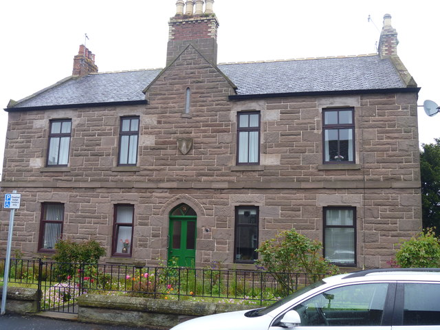
Image: © Michael Dibb Taken: 13 Jun 2016
This interesting property displays a feature typical of many in Montrose in the gabled chimney stack of the front elevation. The datestone above the front door reads 1885 and the property is listed, category C(S), with details at: http://www.britishlistedbuildings.co.uk/sc-46177-30-and-31-christie-s-lane-including-bound#.V4CxcTU5t8E
Images are licensed for reuse under creativecommons.org/licenses/by-sa/2.0
Image Location
Latitude
56.710957
Longitude
-2.459637