IMAGES TAKEN NEAR TO
Bayview Road, MONTROSE, DD10 0SH

Introduction

This page details the photographs taken nearby to Bayview Road, DD10 0SH by members of the Geograph project.

The Geograph project started in 2005 with the aim of publishing, organising and preserving representative images for every square kilometre of Great Britain, Ireland and the Isle of Man.

There are currently over 7.5m images from over14,400 individuals and you can help contribute to the project by visiting https://www.geograph.org.uk

Image Map


Images are licensed for reuse under creativecommons.org/licenses/by-sa/2.0
Notes
  • Clicking on the map will re-center to the selected point.
  • The higher the marker number, the further away the image location is from the centre of the postcode.

Image Listing (89 Images Found)

Images are licensed for reuse under creativecommons.org/licenses/by-sa/2.0
  • ...
Image
Details
Distance
1
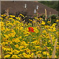
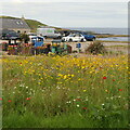
Flowers, Inverbervie
By the beach carpark.
Image: © Richard Webb Taken: 21 Jul 2024
0.10 miles
2
Hercules Linton [3]
A famous son of Inverbervie, Hercules designed the clipper Cutty Sark. He is buried in the old kirkyard. See Image and Image
Image: © Michael Dibb Taken: 17 Jun 2016
0.11 miles
3
Old graveyard
Seen from Kirkburn, is the entrance to the old graveyard surrounding the old parish kirk Image
Image: © Michael Dibb Taken: 17 Jun 2016
0.11 miles
4
Beach carpark, Inverbervie
Using land that was part of Inverbervie railway station.
Image: © Richard Webb Taken: 21 Jul 2024
0.12 miles
5
Site of Inverbervie Station
View SE, towards Montrose; ex-North British, Montrose - Inverbervie branch, which closed for passengers on 4/5/64, for goods on 25/1/65.
Image: © Ben Brooksbank Taken: 21 Sep 1974
0.12 miles
6
Inverbervie Old Parish Church and burial ground
The old parish church at Inverbervie was built in 1781 and remained in use until 1837. A gable wall, partially obscured by the trees, is all that remains
Image: © Euan Nelson Taken: 19 Jun 2015
0.12 miles
7
Old parish kirk
The remains of the old kirk which went out of use in 1837. The ruins are listed, category C(S), with details at: http://www.britishlistedbuildings.co.uk/sc-35069-bervie-old-parish-kirk-#.V5GrhDU5t8E
Image: © Michael Dibb Taken: 17 Jun 2016
0.12 miles
8
Bervie Old Kirk
Image: © C Page Taken: Unknown
0.12 miles
9
Bervie Bowling Club
The bowling green from Kirkburn in Inverbervie.
Image: © Scott Cormie Taken: 25 Nov 2022
0.13 miles
10
Site of Inverbervie station, 2002
View SE, towards Montrose; ex-NBR Montrose - Inverbervie branch, which closed for passengers on 4/5/64, for goods on 25/1/65. The station had been on the right, called 'Bervie' until 5/7/26. There is not much change since 1974: Image
Image: © Ben Brooksbank Taken: 29 Jun 2002
0.13 miles
  • ...