IMAGES TAKEN NEAR TO
Brae Road, MONTROSE, DD10 0LX

Introduction

This page details the photographs taken nearby to Brae Road, DD10 0LX by members of the Geograph project.

The Geograph project started in 2005 with the aim of publishing, organising and preserving representative images for every square kilometre of Great Britain, Ireland and the Isle of Man.

There are currently over 7.5m images from over14,400 individuals and you can help contribute to the project by visiting https://www.geograph.org.uk

Image Map


Images are licensed for reuse under creativecommons.org/licenses/by-sa/2.0
Notes
  • Clicking on the map will re-center to the selected point.
  • The higher the marker number, the further away the image location is from the centre of the postcode.

Image Listing (121 Images Found)

Images are licensed for reuse under creativecommons.org/licenses/by-sa/2.0
  • ...
Image
Details
Distance
1
Gourdon: near site of former station, 2002
View northward, towards Inverbervie: this probably on the course of the ex-NBR Montrose - Inverbervie branch, which lasted until 23/5/66. The station had however been about 200 yards to the south and was closed to passengers 1/10/51.
Image: © Ben Brooksbank Taken: 29 Jun 2002
0.01 miles
2
Brae Street, Gourdon
This tower faces the sea, and is connected to the harbour by steps. It is an upper 'Leading Light', part of a system indicating the correct approach to Gourdon harbour through a gap in the rocky shore. Admiralty Pilot NP54 describes it as a white tower, 6m in height; 120m N of the front light.
Image: © Stanley Howe Taken: 31 Jul 2007
0.02 miles
3
Caldwell Braes and the village of Gourdon
From a layby on the A92.
Image: © Stanley Howe Taken: 20 Aug 2013
0.03 miles
4
'The Gourdon Shop'
Upper Brae Street.
Image: © Stanley Howe Taken: 31 Jul 2007
0.06 miles
5
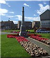
Gourdon war memorial
Image: © Stanley Howe Taken: 31 Jul 2007
0.07 miles
6
Gourdon Leading Light
Situated high above the harbour on Brae Road this is one of a pair of lights to guide boats into the harbour.
Image: © Andrew Wood Taken: 19 Nov 2016
0.08 miles
7
A Glimpse of Gourdon
A quick glimpse of Gourdon from the hilltop.
Image: © Andrew Wood Taken: 19 Nov 2016
0.08 miles
8
A part of Gourdon Cemetery
Looking westward towards private housing on Brae Road.
Image: © Peter Wood Taken: 8 Aug 2021
0.11 miles
9
Ordnance Survey Cut Mark
This mark can be found on the roadside boundary wall of Gourdon Cemetery. The recorded details give a height of 40.4409 metres above sea level. For more detail see : https://www.bench-marks.org.uk/bm162450
Image: © Peter Wood Taken: 8 Aug 2021
0.11 miles
10
Gates to Gourdon Cemetery
Off Brae Road. North Sea in background.
Image: © Stanley Howe Taken: 12 Jul 2017
0.12 miles
  • ...