
IMAGES TAKEN NEAR TO
Inverbervie, MONTROSE, DD10 0EE
Introduction
This page details the photographs taken nearby to DD10 0EE by members of the Geograph project.
The Geograph project started in 2005 with the aim of publishing, organising and preserving representative images for every square kilometre of Great Britain, Ireland and the Isle of Man.

There are currently over 7.5m images from over14,400 individuals and you can help contribute to the project by visiting https://www.geograph.org.uk
Image Map
Images are licensed for reuse under creativecommons.org/licenses/by-sa/2.0
Notes
- Clicking on the map will re-center to the selected point.
- The higher the marker number, the further away the image location is from the centre of the postcode.
Image Listing (14 Images Found)
Images are licensed for reuse under creativecommons.org/licenses/by-sa/2.0
Image
Details
Distance
1

Pitcarry Mill
Beyond a mown field a bank of purplish haar is moving inland to engulf the houses at Mill of Pitcarry.
Image: © Anne Burgess
Taken: 12 Jul 2025
0.01 miles
2
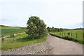
Pitscarry Mill
The access road to Pitscarry Mill by Inverbervie.
Image: © Andrew Wood
Taken: 27 May 2011
0.12 miles
3

Pitcarry Burn in Haar
The heat of the Sun has waned as the day wears on, and is now no longer enough to keep at bay the haar creeping inland from the sea.
Image: © Anne Burgess
Taken: 12 Jul 2025
0.12 miles
4
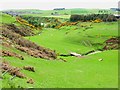
Pitcarry valley
Leading down to the lower end of the Bervie valley.
Image: © Oliver Dixon
Taken: 25 May 2006
0.13 miles
5
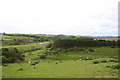
Pitscarry Course
The depression of the Pitscarry Burn as it joins the Bervie Water.
Image: © Andrew Wood
Taken: 27 May 2011
0.14 miles
6
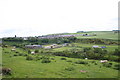
Sheep above Bervie
Sheep grazing by Inverbervie separated from the village by the gorge formed by the Pitcarry Burn.
Image: © Andrew Wood
Taken: 27 May 2011
0.14 miles
7
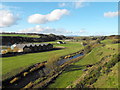
Bervie Water, Inverbervie
Looking up the Bervie Water from the west side of the old bridge. The buildings on the Left are called The Haughs on the OS with Upper Mill to the centre. These buildings and others in the area are used for light industry.
Image: © Dona Robbins
Taken: 30 Oct 2010
0.16 miles
8
Road (B967) near to Pitcarry
Looking north-westward.
Image: © Peter Wood
Taken: 7 Aug 2021
0.17 miles
9
Road (B967) approaching the A92 and Inverbervie
Looking south-eastward.
Image: © Peter Wood
Taken: 7 Aug 2021
0.19 miles
10
Looking towards Inverbervie
Harvest colours
Image: © pamela
Taken: 18 Aug 2004
0.19 miles