IMAGES TAKEN NEAR TO
Calcroft Avenue, GREENHITHE, DA9 9XE
Introduction
This page details the photographs taken nearby to Calcroft Avenue, DA9 9XE by members of the Geograph project.
The Geograph project started in 2005 with the aim of publishing, organising and preserving representative images for every square kilometre of Great Britain, Ireland and the Isle of Man.

There are currently over 7.5m images from over14,400 individuals and you can help contribute to the project by visiting https://www.geograph.org.uk
Image Map
Images are licensed for reuse under creativecommons.org/licenses/by-sa/2.0
Notes
- Clicking on the map will re-center to the selected point.
- The higher the marker number, the further away the image location is from the centre of the postcode.
Image Listing (78 Images Found)
Images are licensed for reuse under creativecommons.org/licenses/by-sa/2.0
Image
Details
Distance
1
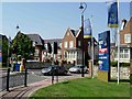
Ingress Park
Ingress Park is an extensive development of executive homes to the east of Greenhithe. They are built in a semi regency style that Prince Charles would probably approve of. The houses look very nice from the outside but as a visitor I found the estate rather like a maze, it took me some time to escape!
Image: © Glyn Baker
Taken: 4 Aug 2005
0.02 miles
2
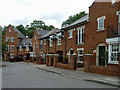
New housing, Ingress Park estate
In The Dell, a 'banjo' close.
Image: © Robin Webster
Taken: 12 Jul 2011
0.06 miles
4
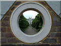
Ingress Abbey
Through the bullion in the seating area overlooking the Thames.
Image: © Ken Brown
Taken: 21 Jul 2008
0.08 miles
5
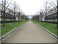
Greenhithe: Ingress Park
Looking from the River Thames down the boulevard in Ingress Park towards Image
Image: © Nigel Cox
Taken: 2 Mar 2008
0.08 miles
6
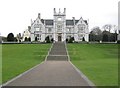
Greenhithe: Ingress Abbey
The building dates from the 1830s when Alderman James Harmer commissioned the architect Charles Moreing to design it. The cost of the house was £120,000 and reclaimed stone from the old London Bridge was used. The building subsequently became the shore base of HMS Worcester, the Thames Nautical Training College, before falling derelict. It was however completely refurbished by the builders Crest Nicholson when they purchased the Ingress Estate in 1991, and now forms the focal point of the Ingress Park residential estate. The building is Grade II listed and is now used as offices.
Image: © Nigel Cox
Taken: 2 Mar 2008
0.08 miles
7
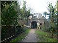
The Grange, Ingress Abbey
Ingress Abbey took its name from a farm once owned by the nuns of Dartford Priory. In 1748, the house was conveyed to Viscount Duncannon, Earl of Bessborough, who with his architect William Chambers was almost certainly responsible for the landscaping in a former chalk quarry to the south of the house and the construction of some of the follies seen today, such as this one known as The Grange. In 1763 the new owner John Calcraft employed Lancelot "Capability" Brown to landscape the parkland around the house and more follies were built. The surviving Historic Landscape is now followed by a heritage trail. The current Ingress Abbey was constructed in 1833 by James Harmer, an Alderman of the City of London and wealthy lawyer. The house incorporated some remnants of the earlier 17th and 18th century house which was mostly demolished in 1815. It is now the centrepiece of the new riverside development of Ingress Park - see http://www.geograph.org.uk/photo/2532502
Image: © Marathon
Taken: 28 Jan 2012
0.08 miles
8
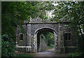
The Grange, Ingress Abbey - south side
This ornamental 'ruined' arch is one of the C19 follies built at Ingress Abbey.
Image: © David Kemp
Taken: 5 Oct 2016
0.08 miles
9
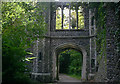
The Grange, Ingress Abbey - north side
This ornamental 'ruined' arch is one of the C19 follies built at Ingress Abbey.
Image: © David Kemp
Taken: 5 Oct 2016
0.08 miles