The Grange, Ingress Abbey
Introduction
The photograph on this page of The Grange, Ingress Abbey by Marathon as part of the Geograph project.
The Geograph project started in 2005 with the aim of publishing, organising and preserving representative images for every square kilometre of Great Britain, Ireland and the Isle of Man.

There are currently over 7.5m images from over 14,400 individuals and you can help contribute to the project by visiting https://www.geograph.org.uk
The Grange, Ingress Abbey
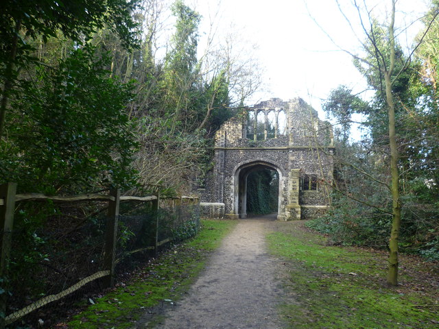
Image: © Marathon Taken: 28 Jan 2012
Ingress Abbey took its name from a farm once owned by the nuns of Dartford Priory. In 1748, the house was conveyed to Viscount Duncannon, Earl of Bessborough, who with his architect William Chambers was almost certainly responsible for the landscaping in a former chalk quarry to the south of the house and the construction of some of the follies seen today, such as this one known as The Grange. In 1763 the new owner John Calcraft employed Lancelot "Capability" Brown to landscape the parkland around the house and more follies were built. The surviving Historic Landscape is now followed by a heritage trail. The current Ingress Abbey was constructed in 1833 by James Harmer, an Alderman of the City of London and wealthy lawyer. The house incorporated some remnants of the earlier 17th and 18th century house which was mostly demolished in 1815. It is now the centrepiece of the new riverside development of Ingress Park - see http://www.geograph.org.uk/photo/2532502
Images are licensed for reuse under creativecommons.org/licenses/by-sa/2.0
Image Location
Latitude
51.451446
Longitude
0.288764