
IMAGES TAKEN NEAR TO
Park Crescent, ERITH, DA8 3EA
Introduction
This page details the photographs taken nearby to Park Crescent, DA8 3EA by members of the Geograph project.
The Geograph project started in 2005 with the aim of publishing, organising and preserving representative images for every square kilometre of Great Britain, Ireland and the Isle of Man.

There are currently over 7.5m images from over14,400 individuals and you can help contribute to the project by visiting https://www.geograph.org.uk
Image Map
Images are licensed for reuse under creativecommons.org/licenses/by-sa/2.0
Notes
- Clicking on the map will re-center to the selected point.
- The higher the marker number, the further away the image location is from the centre of the postcode.
Image Listing (36 Images Found)
Images are licensed for reuse under creativecommons.org/licenses/by-sa/2.0
Image
Details
Distance
1
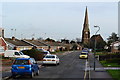
Christchurch Road, looking towards Christchurch, Erith
Image: © David Martin
Taken: 26 Jan 2013
0.09 miles

5

Christ Church (C of E), Erith, Kent
A few hundred yards south of Erith station. Not a good quality of image owing to high wind at the time!
Image: © Dr Neil Clifton
Taken: 27 Mar 2006
0.15 miles
6

Erith: De Luci Fish Mosaic Sculpture and the Town Hall
The mosaic sculpture, on the A2016 Bronze Age Way roundabout, was inspired by the former Erith Urban District Council's coat of arms, featuring three intertwined pikes. This itself was adopted from the family arms of Richard de Luci, a supporter of King Stephen, and owner of Erith during the reigns of King Stephen and King Henry II. The artist who created the sculpture is Gary Drostle http://www.drostle.com/ .
Until 1965 and its incorporation into the London Borough of Bexley, Erith Urban District Council ran its activities from the Town Hall. The building still retains some local government service activities.
From a Geograph point of view the Town Hall is actually just in Image, with the gridline between the two squares running just in front of the façade.
Beyond the Town Hall and further into Image are the Bosworth and Carrack House towerblocks in Saltford Close.
Image: © Nigel Cox
Taken: 2 Mar 2008
0.15 miles
7

Erith railway station
The original 1849 station building designed by Samuel Beazley is still in use and can be seen in the distance on the right. The station layout features the classic South Eastern Railway staggered platform design with up and down platforms leading away in opposite directions from the central ticket office. This arrangement was constructed where a footbridge was not provided and allowed passengers to cross behind trains if two were at the station simultaneously. Current Network Rail safety officials would have an apoplexy! Obviously here at Erith the line was later electrified and a footbridge joining the two platforms was subsequently built. The platform on the right is the down platform. See Neil's Image for a view of the up platform.
From a cartographical and Geograph point of view the 178000 northing gridline passes across the down platform a little way up the line, so the station infrastructure straddles two grid squares. This was taken from the Bexley Road bridge. For a view in the opposite direction from this bridge see Image
Image: © Nigel Cox
Taken: 2 Mar 2008
0.15 miles
8
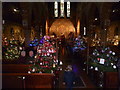
Erith Christmas Tree Festival 2014 - Christ Church, Erith
The 9th Erith Christmas Tree Festival was held as always in the Grade II* Listed Christ Church. Consecrated in 1874, the church is especially noted for its murals. This view looks towards the west end.
For the 2014 Festival, 80 real trees were decorated and they made an impressive sight, especially as it grew dark. During the three days some 2,000 people came to see them.
Image: © Marathon
Taken: 13 Dec 2014
0.16 miles
9

Victoria Road, Erith
The spire is Christ Church.
Image: © David Howard
Taken: 27 Sep 2025
0.16 miles
10
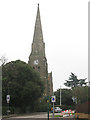
Christ Church, Erith
This Anglican parish church on Victoria Road, Erith has a distinctive spire. It was built in 1874 to the designs of J P St Aubyn. It is listed grade 2* (listed building number 198721 or Heritage asset number 11885498 as from 2011).
Image: © Stephen Craven
Taken: 20 Feb 2011
0.16 miles