
IMAGES TAKEN NEAR TO
Cloudesley Road, ERITH, DA8 2DA
Introduction
This page details the photographs taken nearby to Cloudesley Road, DA8 2DA by members of the Geograph project.
The Geograph project started in 2005 with the aim of publishing, organising and preserving representative images for every square kilometre of Great Britain, Ireland and the Isle of Man.

There are currently over 7.5m images from over14,400 individuals and you can help contribute to the project by visiting https://www.geograph.org.uk
Image Map
Images are licensed for reuse under creativecommons.org/licenses/by-sa/2.0
Notes
- Clicking on the map will re-center to the selected point.
- The higher the marker number, the further away the image location is from the centre of the postcode.
Image Listing (18 Images Found)
Images are licensed for reuse under creativecommons.org/licenses/by-sa/2.0
Image
Details
Distance
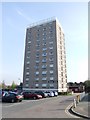
2

Bridge Road at the end of Whitehall Lane
Image: © David Howard
Taken: 27 Sep 2025
0.12 miles
3
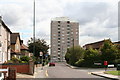
Orchard House, North End, Kent
Large block of flats situated on the east side of the A206.
Image: © Dr Neil Clifton
Taken: 30 Aug 2006
0.12 miles

5

Route 428 bus on Bridge Road
Heading for Bluewater, having started at Erith.
Image: © Robin Webster
Taken: 5 Mar 2012
0.13 miles
6
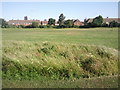
Looking across Whitehall Lane Open Space, Slade Green
The houses are at North End and the distant flats are in Erith.
Image: © Marathon
Taken: 15 Jun 2010
0.14 miles
7
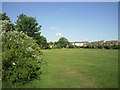
Whitehall Lane Open Space, Slade Green
Formerly known as Slade Green Recreation Ground, this is now called Whitehall Lane Open Space. The eastern half is rather wilder than the western half seen here.
Image: © Marathon
Taken: 15 Jun 2010
0.14 miles

10

Paths in Slade Green Recreational Ground
A path leads from Bridge road to Whitehall Lane.
Another path leads left across the grassland towards Slade Green Railway Station on Forest Road.
Image: © David Anstiss
Taken: 7 Aug 2011
0.19 miles