
IMAGES TAKEN NEAR TO
Shermansbury Close, ERITH, DA8 2BF
Introduction
This page details the photographs taken nearby to Shermansbury Close, DA8 2BF by members of the Geograph project.
The Geograph project started in 2005 with the aim of publishing, organising and preserving representative images for every square kilometre of Great Britain, Ireland and the Isle of Man.

There are currently over 7.5m images from over14,400 individuals and you can help contribute to the project by visiting https://www.geograph.org.uk
Image Map
Images are licensed for reuse under creativecommons.org/licenses/by-sa/2.0
Notes
- Clicking on the map will re-center to the selected point.
- The higher the marker number, the further away the image location is from the centre of the postcode.
Image Listing (18 Images Found)
Images are licensed for reuse under creativecommons.org/licenses/by-sa/2.0
Image
Details
Distance
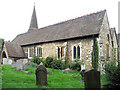
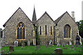
3
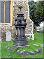
St John the Baptist, Erith, Kent - Churchyard
Image: © John Salmon
Taken: 21 Sep 2005
0.09 miles
4
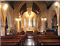
St John the Baptist, Erith, Kent - East end
Image: © John Salmon
Taken: 21 Sep 2005
0.09 miles
5
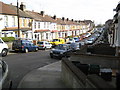
Erith: Thanet Road
Thanet Road is an enclave of Victorian terraced houses surrounded by modern developments.
Image: © Nigel Cox
Taken: 2 Mar 2008
0.14 miles
6
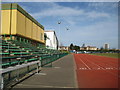
Erith Stadium
There was a cinder athletics track here from the 1950s, but the current stadium was built in 1998/99 with a £1 million National Lottery grant. The seating capacity is about 1,000. The infield is used by Erith Town FC who currently (2007/08 season) play in the Kent Football League Premier Division.
Image: © Nigel Cox
Taken: 2 Mar 2008
0.15 miles
7
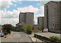
Boundary Road, Erith
High-rise housing to the south east of Erith.
Image: © Alan Murray-Rust
Taken: 26 Apr 2009
0.15 miles
8
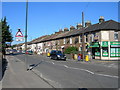
Manor Road, Erith (2)
At the junction of Appold Street
Image: © Danny P Robinson
Taken: 27 Aug 2006
0.17 miles
9
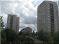
Three Blocks of Flats
As seen from a footpath near Frobisher Road.
Looking across the railway line, at the blocks on Boundary Street and Arthur Street.
Image: © David Anstiss
Taken: 7 Aug 2011
0.18 miles
