
IMAGES TAKEN NEAR TO
Riverdale Road, ERITH, DA8 1PY
Introduction
This page details the photographs taken nearby to Riverdale Road, DA8 1PY by members of the Geograph project.
The Geograph project started in 2005 with the aim of publishing, organising and preserving representative images for every square kilometre of Great Britain, Ireland and the Isle of Man.

There are currently over 7.5m images from over14,400 individuals and you can help contribute to the project by visiting https://www.geograph.org.uk
Image Map
Images are licensed for reuse under creativecommons.org/licenses/by-sa/2.0
Notes
- Clicking on the map will re-center to the selected point.
- The higher the marker number, the further away the image location is from the centre of the postcode.
Image Listing (13 Images Found)
Images are licensed for reuse under creativecommons.org/licenses/by-sa/2.0
Image
Details
Distance
1
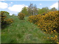
Holly Hill Open Space
Holly Hill Open Space rises up steeply above the back gardens of Riverdale Road to Holly Hill Road at the top. This patch of gorse is half way up the slope.
Image: © Marathon
Taken: 19 Apr 2016
0.14 miles
2
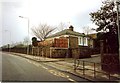
The Lodge, The Oaks, Erith Road, Erith 1990
The Lodge is currently attached to Trinity School, Erith. This photograph was taken in 1990. The building was formerly the lodge for The Oaks, a mansion in Franks Park. (There also exists an image of the building when occupied by gardener John Beckwith and his family in 1881.)
Image: © Clint Mann
Taken: Unknown
0.15 miles
3
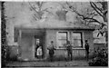
The Lodge, The Oaks, Erith circa 1881
This image of The Lodge at The Oaks, Erith was taken circa 1881. The building is currently attached to Trinity School. The photograph features Mary Anna Beckwith (nee Cone) in the doorway with daughter Annie Eliza Beckwith. The man in the middle is gardener John Beckwith (great-grandfather of Clinton Mann), who lived with his family in this building and who worked on the estate of The Oaks. The photograph was probably taken by John's sister, Amelia Beckwith, whose husband John Lyne was a gardener on a Belvedere Estate in 1881.
Image: © Amelia Beckwith
Taken: Unknown
0.15 miles
5
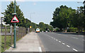
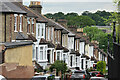
Erith Road - Steep Hill 1:9
Erith Road, Belvedere. 1:9 steep hill down sign.
Image: © Adam Morse
Taken: 8 Aug 2009
0.18 miles
6
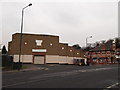
Kingdom Hall, Erith
Jehovah's Witness building on the junction of Deluci Road (on the left) and Erith Road (on the right).
On the far right is Image
Image: © David Anstiss
Taken: 27 Feb 2012
0.20 miles
7
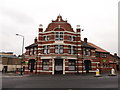
Fancy facade, Erith
According to the Lost Pubs project this was The Nordenfeldt Public House.
See http://www.closedpubs.co.uk/kent/erith_nordenfeldt.html.
It has now been converted into apartments.
Image: © David Anstiss
Taken: 27 Feb 2012
0.20 miles
8
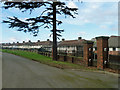
A corner of Erith Cemetery
The pedestrian entrance from Riverdale Road on the right is now permanently shut off.
Image: © Robin Webster
Taken: 5 Mar 2012
0.21 miles
9
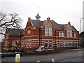
Bexley College, Holly Hill Campus
Former Erith Technical Institute and Secondary School on the A206 Erith Road. Now Grade II listed.
See http://www.britishlistedbuildings.co.uk/en-475520-bexley-college-former-erith-technical-in for more details about the building.
See also http://en.wikipedia.org/wiki/Bexley_College for more details about the college.
Image: © David Anstiss
Taken: 27 Feb 2012
0.22 miles
10
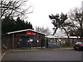
Army Cadet Force, Belvedere
109 Cadet Battery Royal Artillery on Fox House Road.
Image: © David Anstiss
Taken: 27 Feb 2012
0.22 miles