
IMAGES TAKEN NEAR TO
Medley Lane, ERITH, DA8 1FF
Introduction
This page details the photographs taken nearby to Medley Lane, DA8 1FF by members of the Geograph project.
The Geograph project started in 2005 with the aim of publishing, organising and preserving representative images for every square kilometre of Great Britain, Ireland and the Isle of Man.

There are currently over 7.5m images from over14,400 individuals and you can help contribute to the project by visiting https://www.geograph.org.uk
Image Map
Images are licensed for reuse under creativecommons.org/licenses/by-sa/2.0
Notes
- Clicking on the map will re-center to the selected point.
- The higher the marker number, the further away the image location is from the centre of the postcode.
Image Listing (122 Images Found)
Images are licensed for reuse under creativecommons.org/licenses/by-sa/2.0
Image
Details
Distance
1

Erith: Running Horses public house
There has been a public house called the Running Horses on this site since before Queen Victoria came to the throne. That pub was replaced by the new Running Horses seen here, designed by the architect G E Clay, and opened in December 1938. Sadly on the 29 November 1940 a bomb exploded very close by, killing several people in the pub, including the landlord, and the pub itself was badly damaged.
Image: © Nigel Cox
Taken: 2 Mar 2008
0.04 miles

3
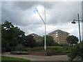
Flag Pole in Riverside Gardens
This council gardens are beside a riverside walk beside the River Thames.
In the background are new housing blocks on Chichester Wharf.
Image: © David Anstiss
Taken: 7 Aug 2011
0.05 miles

5
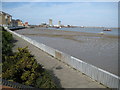
Erith: William Cory Promenade
This promenade along the River Thames frontage and Riverside Gardens commemorates William Cory who was a well-established coal merchant in North Kent. It may be that this area was once a wharf that the Cory company used to transport coal.
Image: © Nigel Cox
Taken: 2 Mar 2008
0.06 miles
6

Tower blocks, Erith
Bosworth House, on the left, and Carrack House.
Image: © Robin Webster
Taken: 30 Jun 2011
0.06 miles
7

Riverside Walk, Erith
View of the River Thames (at low tide).
Seen from the Riverside Gardens along Erith High Street.
Image: © David Anstiss
Taken: 7 Aug 2011
0.06 miles
8

Riverside Walk near Riverside Gardens
A promenade starts from the gardens on Erith High Street around the various re-developed wharfs of Erith heading towards Belvedere.
Image: © David Anstiss
Taken: 7 Aug 2011
0.06 miles
9
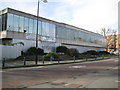
Erith: Former Riverside Swimming Pool (1)
Due for demolition as part of the Erith Western Gateway redevelopment, the swimming pool is currently a terrible eyesore with broken windows, graffiti, and around the back at least a high corrugated metal fence. There is a mural on the end wall around the far corner which will be preserved I understand. See Image
Image: © Nigel Cox
Taken: 2 Mar 2008
0.06 miles
10
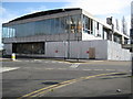
Erith: Former Riverside Swimming Pool (2)
The pool was designed by the late architect Richard Seifert and opened in 1968. This is the west gable end which contains a mural by the artist William Mitchell entitled "Erith's History". This mural, which is the dark rectangle to the left of the building, is now in a parlous unprotected state, although I understand it will be saved when the building is demolished for the Erith Western Gateway redevelopment. See Image for the main frontage.
Image: © Nigel Cox
Taken: 2 Mar 2008
0.06 miles