
IMAGES TAKEN NEAR TO
Maxim Road, ERITH, DA8 1FA
Introduction
This page details the photographs taken nearby to Maxim Road, DA8 1FA by members of the Geograph project.
The Geograph project started in 2005 with the aim of publishing, organising and preserving representative images for every square kilometre of Great Britain, Ireland and the Isle of Man.

There are currently over 7.5m images from over14,400 individuals and you can help contribute to the project by visiting https://www.geograph.org.uk
Image Map
Images are licensed for reuse under creativecommons.org/licenses/by-sa/2.0
Notes
- Clicking on the map will re-center to the selected point.
- The higher the marker number, the further away the image location is from the centre of the postcode.
Image Listing (53 Images Found)
Images are licensed for reuse under creativecommons.org/licenses/by-sa/2.0
Image
Details
Distance
2
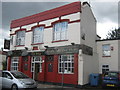
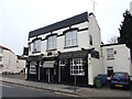
The Ship, Public House, Erith
On West Street.
Image: © David Anstiss
Taken: 7 Aug 2011
0.03 miles
3
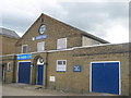
St. John's Hall, Erith
Former church hall on West Street.
Now converted into a company premises.
Image: © David Anstiss
Taken: 7 Aug 2011
0.06 miles
4

Ocean Park, Erith
A development of flats on an old industrial site. The name is a typical bit of exaggeration used by those involved in selling residential property.
Image: © Robin Webster
Taken: 30 Jun 2011
0.08 miles
5

Derelict jetties on the Thames at Erith
Image: © David Martin
Taken: 28 Feb 2015
0.09 miles
6

Tidal defences and riverside apartments, Erith
Image: © David Martin
Taken: 6 Jun 2021
0.10 miles

8
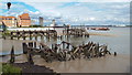
Derelict landing stages, River Thames at Erith
These wooden ruins are the remains of landing stages on the bank of the River Thames. This image was taken when the tide was low, leaving mudflats exposed.
Image: © Malc McDonald
Taken: 7 Sep 2013
0.11 miles

10

New housing developments on the riverside at Erith
The picture shows apartment blocks at Chichester Wharf (centre and left) and Chandlers Drive (right hand side in the distance), viewed from Erith Deep Wharf.
Image: © Simon Mortimer
Taken: 15 Mar 2009
0.12 miles