
IMAGES TAKEN NEAR TO
Eversley Avenue, BEXLEYHEATH, DA7 6SW
Introduction
This page details the photographs taken nearby to Eversley Avenue, DA7 6SW by members of the Geograph project.
The Geograph project started in 2005 with the aim of publishing, organising and preserving representative images for every square kilometre of Great Britain, Ireland and the Isle of Man.

There are currently over 7.5m images from over14,400 individuals and you can help contribute to the project by visiting https://www.geograph.org.uk
Image Map
Images are licensed for reuse under creativecommons.org/licenses/by-sa/2.0
Notes
- Clicking on the map will re-center to the selected point.
- The higher the marker number, the further away the image location is from the centre of the postcode.
Image Listing (16 Images Found)
Images are licensed for reuse under creativecommons.org/licenses/by-sa/2.0
Image
Details
Distance
1
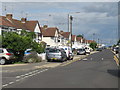
Parkside Avenue, Barnehurst
Parkside Avenue in barnehurst, on the outer fringe of south east London. Just visible in the Queen Elizabeth II Bridge which links Kent with Essex.
Image: © Malc McDonald
Taken: 14 Jul 2019
0.10 miles
2

Railway bridge over A206
Northend Road leads towards Erith.
Over the road the bridge carries the railway from Dartford (heading left) towards Barnehurst.
Image: © David Anstiss
Taken: 7 Aug 2011
0.12 miles
3
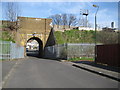
Barnehurst: Eversley Cross railway bridge
The railway line east of Barnehurst station runs on a high embankment, and two residential roads, Eversley Avenue and Parkside Avenue, run parallel to it, to the north and south respectively. The embankment is cut by a couple of minor lanes that link between these two roads. This one is Eversley Cross, the other, with a much higher, but equally narrow bridge, is Parkside Cross.
Image: © Nigel Cox
Taken: 2 Mar 2008
0.13 miles
4
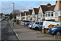
Parked cars in Holmsdale Grove
Typical of the smaller 1930s house designs in this area, built as short terraces. The lack of driveways has led to most front gardens being converted to off-street parking.
Image: © David Martin
Taken: 16 Feb 2022
0.16 miles
6
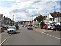
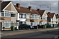
Holmsdale Grove, Barnehurst
Holmsdale Grove is a residential road in Barnehurst, on the outermost fringe of south east London.
Image: © Malc McDonald
Taken: 14 Jul 2019
0.17 miles

9

Quantock Road at the junction of Hurstwood Avenue
Image: © David Howard
Taken: 27 Sep 2025
0.18 miles
10
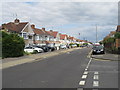
Parkside Avenue, Barnehurst
Parkside Avenue in Barnehurst, on the outer fringe of south east London.
Image: © Malc McDonald
Taken: 14 Jul 2019
0.18 miles