IMAGES TAKEN NEAR TO
Martens Avenue, BEXLEYHEATH, DA7 6BB
Introduction
This page details the photographs taken nearby to Martens Avenue, DA7 6BB by members of the Geograph project.
The Geograph project started in 2005 with the aim of publishing, organising and preserving representative images for every square kilometre of Great Britain, Ireland and the Isle of Man.

There are currently over 7.5m images from over14,400 individuals and you can help contribute to the project by visiting https://www.geograph.org.uk
Image Map
Images are licensed for reuse under creativecommons.org/licenses/by-sa/2.0
Notes
- Clicking on the map will re-center to the selected point.
- The higher the marker number, the further away the image location is from the centre of the postcode.
Image Listing (18 Images Found)
Images are licensed for reuse under creativecommons.org/licenses/by-sa/2.0
Image
Details
Distance
1
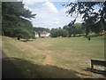
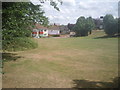
Martens Grove Park
When much of the area of Barnehurst was built-up in the 1930s, a number of the old historic parks were left, although in the case of Martens Grove Park the house has gone.
Image: © Marathon
Taken: 2 Jul 2010
0.06 miles
2
Martens Grove Park
This is an interesting and varied park, with steep wooded slopes as well as more open grassland. The gasholder in the distance is in Crayford.
Image: © Marathon
Taken: 2 Jul 2010
0.07 miles
4
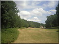
Martens Grove Park
This is an interesting and varied park, located between Crayford, Bexleyheath and Barnehurst. It features wooded slopes and open grassy areas.
Image: © Marathon
Taken: 2 Jul 2010
0.11 miles
7
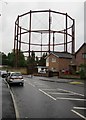
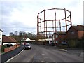
Derelict gas-holder, London Road gas-works, Crayford
I'm assuming this is derelict, as it's rusty and plainly hasn't had a coat of paint for many years.
The gas-works site lies at a fork in the road - London Road passes to the south, Old Road (from which this photo was taken) runs along the northern boundary.
Image: © Stefan Czapski
Taken: 31 Aug 2015
0.14 miles