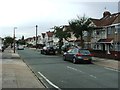
IMAGES TAKEN NEAR TO
Howard Avenue, BEXLEY, DA5 3BD
Introduction
This page details the photographs taken nearby to Howard Avenue, DA5 3BD by members of the Geograph project.
The Geograph project started in 2005 with the aim of publishing, organising and preserving representative images for every square kilometre of Great Britain, Ireland and the Isle of Man.

There are currently over 7.5m images from over14,400 individuals and you can help contribute to the project by visiting https://www.geograph.org.uk
Image Map
Images are licensed for reuse under creativecommons.org/licenses/by-sa/2.0
Notes
- Clicking on the map will re-center to the selected point.
- The higher the marker number, the further away the image location is from the centre of the postcode.
Image Listing (43 Images Found)
Images are licensed for reuse under creativecommons.org/licenses/by-sa/2.0
Image
Details
Distance
1
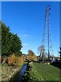
River Shuttle seen from Albany Road
The Shuttle rises on the northern edge of Avery Hill Park and flows into the River Cray near Hall Place. This is just downriver from Lamorbey Park where the Shuttle forms a lake - see https://www.geograph.org.uk/photo/6747780
The linear parkland follows the river and is followed by the Shuttle Riverway - see http://walkaroundlondon.com/the-sunny-shuttle-riverway-and-a-bit-more/
Image: © Marathon
Taken: 5 Feb 2021
0.06 miles
2
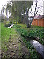
The River Shuttle looking towards Albany Road
Looking upstream to where electricity power lines cross the river. The Shuttle Riverway follows the river.
Image: © Kenneth Yarham
Taken: 26 Nov 2006
0.06 miles
3

Albany Road bridge over River Shuttle
The Shuttle Riverway (5 mile walk) follows the river between the River Cray and Avery Hill.
Image: © David Anstiss
Taken: 15 Aug 2011
0.07 miles
4
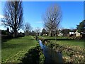
Looking upriver along the River Shuttle near Albany Road
The Shuttle rises on the northern edge of Avery Hill Park and flows into the River Cray near Hall Place. This is just downriver from Lamorbey Park where the Shuttle forms a lake - see https://www.geograph.org.uk/photo/6747780
The linear parkland follows the river and is followed by the Shuttle Riverway - see http://walkaroundlondon.com/the-sunny-shuttle-riverway-and-a-bit-more/
Image: © Marathon
Taken: 5 Feb 2021
0.07 miles
5
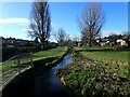
Looking upriver along the River Shuttle near Albany Road
The Shuttle rises on the northern edge of Avery Hill Park and flows into the River Cray near Hall Place. This is just downriver from Lamorbey Park where the Shuttle forms a lake - see https://www.geograph.org.uk/photo/6747780
The linear parkland follows the river and is followed by the Shuttle Riverway - see http://walkaroundlondon.com/the-sunny-shuttle-riverway-and-a-bit-more/
Image: © Marathon
Taken: 5 Feb 2021
0.09 miles
6
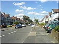
Suburban housing, Howard Avenue
Smaller 1930s housing typical of this area, originally built as short terraces of four, although many have now been joined into continuous terraces by extending the end houses right up to their neighbour's boundary. The narrow street width has caused most front gardens to be converted to off-road parking.
Image: © David Martin
Taken: 17 Jun 2008
0.10 miles
7
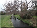
River Shuttle near Crofton Avenue
A succession of open spaces have been preserved amongst the suburban housing alongside the River Shuttle. The Shuttle Riverway follows these. This looks upstream from near Crofton Avenue.
Image: © Marathon
Taken: 29 Jan 2023
0.12 miles
8
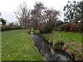
River Shuttle near Crofton Avenue
A succession of open spaces have been preserved amongst the suburban housing alongside the River Shuttle. The Shuttle Riverway follows these. This looks upstream from near Crofton Avenue.
Image: © Marathon
Taken: 29 Jan 2023
0.13 miles
9

The River Shuttle
As seen from Crofton Avenue.
The Shuttle Riverway (5 mile walk) follows the river.
Image: © David Anstiss
Taken: 15 Aug 2011
0.13 miles