IMAGES TAKEN NEAR TO
Hall Place Crescent, BEXLEY, DA5 1PS
Introduction
This page details the photographs taken nearby to Hall Place Crescent, DA5 1PS by members of the Geograph project.
The Geograph project started in 2005 with the aim of publishing, organising and preserving representative images for every square kilometre of Great Britain, Ireland and the Isle of Man.

There are currently over 7.5m images from over14,400 individuals and you can help contribute to the project by visiting https://www.geograph.org.uk
Image Map
Images are licensed for reuse under creativecommons.org/licenses/by-sa/2.0
Notes
- Clicking on the map will re-center to the selected point.
- The higher the marker number, the further away the image location is from the centre of the postcode.
Image Listing (68 Images Found)
Images are licensed for reuse under creativecommons.org/licenses/by-sa/2.0
Image
Details
Distance
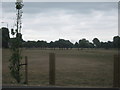
1
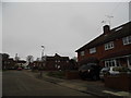
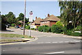
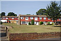
Hall Place, Bexley
This is a council estate but runs along the edge of the grounds of the stately home of the same name.
Image: © David Howard
Taken: 6 Jan 2013
0.02 miles
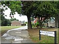
2
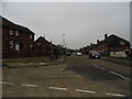
Hall Place, Bexley
The council estate on the edge of the grounds of the stately home Hall Place.
Image: © David Howard
Taken: 6 Jan 2013
0.02 miles
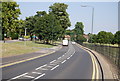
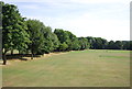
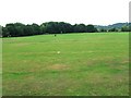
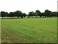
8
Recreation Ground of Hall Place
These are the very dry grassed areas of Hall Place. Seen from a new road to a car park near the football pitches.
Image: © David Anstiss
Taken: 6 Aug 2010
0.10 miles