IMAGES TAKEN NEAR TO
Thornton Road, BELVEDERE, DA17 6DD
Introduction
This page details the photographs taken nearby to Thornton Road, DA17 6DD by members of the Geograph project.
The Geograph project started in 2005 with the aim of publishing, organising and preserving representative images for every square kilometre of Great Britain, Ireland and the Isle of Man.

There are currently over 7.5m images from over14,400 individuals and you can help contribute to the project by visiting https://www.geograph.org.uk
Image Map
Images are licensed for reuse under creativecommons.org/licenses/by-sa/2.0
Notes
- Clicking on the map will re-center to the selected point.
- The higher the marker number, the further away the image location is from the centre of the postcode.
Image Listing (57 Images Found)
Images are licensed for reuse under creativecommons.org/licenses/by-sa/2.0
Image
Details
Distance
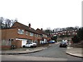
5
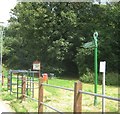
Green Chain Walk enters Frank's Park
The long distance walk leaves Halt Robin Road to pass through the park (via Halt Robin track) towards Valley Road (track) and road in Erith.
Image: © David Anstiss
Taken: 7 Aug 2011
0.08 miles
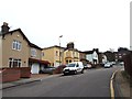
6
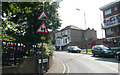
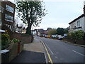
Picardy Road - Steep Hill 10%
Picardy Road, Belvedere. 10% steep hill up sign.
Image: © Adam Morse
Taken: 8 Aug 2009
0.09 miles
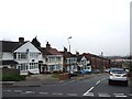
9
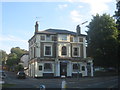
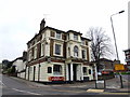
The Belvedere Public House
On the junction of Lower Park Road (on the left) and Picardy Road (on the right).
Image: © David Anstiss
Taken: 21 Aug 2011
0.09 miles