IMAGES TAKEN NEAR TO
Byron Road, DARTFORD, DA1 5NT
Introduction
This page details the photographs taken nearby to Byron Road, DA1 5NT by members of the Geograph project.
The Geograph project started in 2005 with the aim of publishing, organising and preserving representative images for every square kilometre of Great Britain, Ireland and the Isle of Man.

There are currently over 7.5m images from over14,400 individuals and you can help contribute to the project by visiting https://www.geograph.org.uk
Image Map
Images are licensed for reuse under creativecommons.org/licenses/by-sa/2.0
Notes
- Clicking on the map will re-center to the selected point.
- The higher the marker number, the further away the image location is from the centre of the postcode.
Image Listing (37 Images Found)
Images are licensed for reuse under creativecommons.org/licenses/by-sa/2.0
Image
Details
Distance
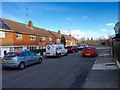
5
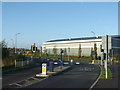
Dartford: Fastrack busway towards Rennie Drive
The Fastrack bus service provides a network of express bus routes in Kent Thameside, in several cases following new dedicated roads. This is the Busway at the eastern end of The Bridge development that allows Fastrack buses on Route 'A', and no other vehicles, to pass under the QEII bridge approach to rejoin the public road system.
Image: © David Anstiss
Taken: 7 Nov 2012
0.10 miles
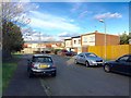
6
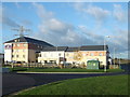
The Beacon Beefeater Grill and Dartford Premier Inn
Restaurant and motel, as seen from Littlebrook Manorway.
Image: © David Anstiss
Taken: 25 Nov 2012
0.11 miles
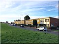
9
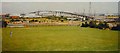
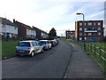
Public Open Space, Temple Hill, Dartford, Kent
A public open space on the NE edge of the housing development, right next to the S side of the Dartford crossing. Queen Elizabeth 2nd Bridge in the background
Image: © Pete Chapman
Taken: 21 Aug 1994
0.13 miles
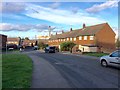
10
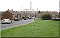
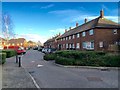
Dartford: Cavell Crescent, Temple Hill
The Temple Hill estate was built by the local council in the immediate post-war years to provide housing for those who had lost their homes due to bombing. The official opening of the first phase of the development took place in 1947. This is Cavell Crescent looking down towards the distant Littlebrook power station.
Image: © Nigel Cox
Taken: 2 Mar 2008
0.16 miles