IMAGES TAKEN NEAR TO
Telford Square, DARTFORD, DA1 5FP
Introduction
This page details the photographs taken nearby to Telford Square, DA1 5FP by members of the Geograph project.
The Geograph project started in 2005 with the aim of publishing, organising and preserving representative images for every square kilometre of Great Britain, Ireland and the Isle of Man.

There are currently over 7.5m images from over14,400 individuals and you can help contribute to the project by visiting https://www.geograph.org.uk
Image Map
Images are licensed for reuse under creativecommons.org/licenses/by-sa/2.0
Notes
- Clicking on the map will re-center to the selected point.
- The higher the marker number, the further away the image location is from the centre of the postcode.
Image Listing (45 Images Found)
Images are licensed for reuse under creativecommons.org/licenses/by-sa/2.0
Image
Details
Distance
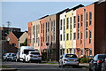
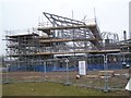
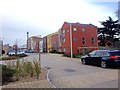
1
Fast Track bus Station and new construction
These shiny new bus stations are part of a new development on the former site of Joyce Green Hospital. The building being built at the moment is a new 'Learning and Community Campus' (primary school plus....). Note, the only people using the buses are builders and none on Sundays when bus 'fly' non-stop through the site. Littlebrook Power Station chimney in background.
Image: © David Anstiss
Taken: 15 Feb 2009
0.04 miles
2
New School construction on empty bus route
Part of a new development on the former site of Joyce Green Hospital. Part of The Bridge. The building being built at the moment is a new 'Learning and Community Campus' (primary school plus....). Beside the new fasttrack bus route, linking the site with Dartford and Greenhithe.
Image: © David Anstiss
Taken: 15 Feb 2009
0.05 miles
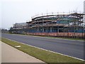
4
New School construction in The Bridge
Part of a new development on the former site of Joyce Green Hospital. Part of The Bridge. The building being built at the moment is a new 'Learning and Community Campus' (primary school plus....). Littlebrook Power Station chimney in background.
Image: © David Anstiss
Taken: 15 Feb 2009
0.05 miles
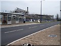
6
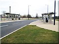
Dartford: Fastrack busway shelters
See Image for information about the busway and a link to the Fastrack site. These shelters are on the dedicated busway route between Joyce Green Lane and the Crossway Boulevard and have been constructed to eventually serve The Bridge development here on the site of the former Joyce Green Hospital. However at the present their swish stainless steelness resides in total isolation from humanity without a building, and therefore passengers, within about 500 metres. One wonders if they will withstand vandalism and the construction site works before they actually serve the purpose for which they were designed... The chimney of Image inevitably looms over the scene.
Image: © Nigel Cox
Taken: 2 Mar 2008
0.06 miles
7
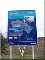
Sign about The Bridge
On former hospital site of Joyce Green. For more details see http://www.thebridgedartford.co.uk
Image: © David Anstiss
Taken: 15 Feb 2009
0.07 miles
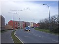
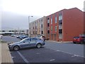
9
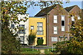
Houses in Brunel Way, seen from footpath
Image: © David Martin
Taken: 7 Nov 2021
0.08 miles