Dartford: Fastrack busway shelters
Introduction
The photograph on this page of Dartford: Fastrack busway shelters by Nigel Cox as part of the Geograph project.
The Geograph project started in 2005 with the aim of publishing, organising and preserving representative images for every square kilometre of Great Britain, Ireland and the Isle of Man.

There are currently over 7.5m images from over 14,400 individuals and you can help contribute to the project by visiting https://www.geograph.org.uk
Dartford: Fastrack busway shelters
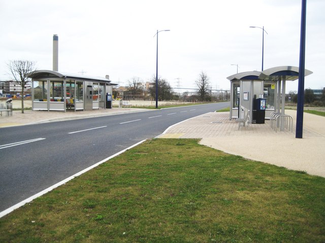
Image: © Nigel Cox Taken: 2 Mar 2008
See Image for information about the busway and a link to the Fastrack site. These shelters are on the dedicated busway route between Joyce Green Lane and the Crossway Boulevard and have been constructed to eventually serve The Bridge development here on the site of the former Joyce Green Hospital. However at the present their swish stainless steelness resides in total isolation from humanity without a building, and therefore passengers, within about 500 metres. One wonders if they will withstand vandalism and the construction site works before they actually serve the purpose for which they were designed... The chimney of Image inevitably looms over the scene.
Images are licensed for reuse under creativecommons.org/licenses/by-sa/2.0
Image Location
Latitude
51.460939
Longitude
0.225463