
IMAGES TAKEN NEAR TO
Minerva Close, SIDCUP, DA14 6PR
Introduction
This page details the photographs taken nearby to Minerva Close, DA14 6PR by members of the Geograph project.
The Geograph project started in 2005 with the aim of publishing, organising and preserving representative images for every square kilometre of Great Britain, Ireland and the Isle of Man.

There are currently over 7.5m images from over14,400 individuals and you can help contribute to the project by visiting https://www.geograph.org.uk
Image Map
Images are licensed for reuse under creativecommons.org/licenses/by-sa/2.0
Notes
- Clicking on the map will re-center to the selected point.
- The higher the marker number, the further away the image location is from the centre of the postcode.
Image Listing (43 Images Found)
Images are licensed for reuse under creativecommons.org/licenses/by-sa/2.0
Image
Details
Distance
4
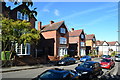
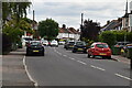
Infill housing, Stafford Road
Three modern houses (centre) in a style very sympathetic to older properties in the street, borrowing the three storey, bay-fronted design of the house on the left.
Image: © David Martin
Taken: 6 Oct 2012
0.07 miles
6
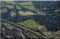
Sidcup from the air
Kemnal Park Cemetery by the A20 road is prominent.
Image: © Thomas Nugent
Taken: 26 Aug 2019
0.08 miles
7

Sidcup from the air
Kemnal Park Cemetery by the A20 road is prominent.
Image: © Thomas Nugent
Taken: 26 Aug 2019
0.09 miles
9
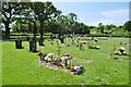
Kemnal Park, graves
At Kemnal Park Cemetery: http://www.kemnalpark.org/
Image: © Mike Faherty
Taken: 27 May 2015
0.12 miles
10
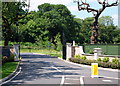
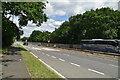
Kemnal Park Cemetery, Chislehurst BR7
The entrance into the Kemnal Park Cemetery and Crematorium off the northwest bound (London-bound) carriageway of the Sidcup By-Pass - a.k.a. the A211). Apparently the northern part of the Kemnal Estate was sold to the London Dock Labour Board by the Trustees of James Kemnal’s will. Part of it was developed into what is now known as the Flamingo Sports Venue with the rest of it remaining empty. It was subsequently designated as part of the Green Belt. Various applications were made for other uses of the land but these were turned down by the London Borough of Bromley. However, in November 2006, permission was granted for the land to be used for human burials and this site is operated as a private (non-local Council) facility.
Image: © David Hallam-Jones
Taken: 17 Jun 2014
0.12 miles