
IMAGES TAKEN NEAR TO
Bunkers Hill, SIDCUP, DA14 5EX
Introduction
This page details the photographs taken nearby to Bunkers Hill, DA14 5EX by members of the Geograph project.
The Geograph project started in 2005 with the aim of publishing, organising and preserving representative images for every square kilometre of Great Britain, Ireland and the Isle of Man.

There are currently over 7.5m images from over14,400 individuals and you can help contribute to the project by visiting https://www.geograph.org.uk
Image Map
Images are licensed for reuse under creativecommons.org/licenses/by-sa/2.0
Notes
- Clicking on the map will re-center to the selected point.
- The higher the marker number, the further away the image location is from the centre of the postcode.
Image Listing (16 Images Found)
Images are licensed for reuse under creativecommons.org/licenses/by-sa/2.0
Image
Details
Distance


4
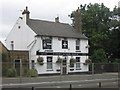
The White Cross Public House, North Cray
Beside the A233 North Cray Road (in the dual carriageway section) on the side heading towards Bexley.
Image: © David Anstiss
Taken: 6 Aug 2010
0.16 miles
5
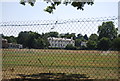
Loring Hall
Grade II listed. http://www.britishlistedbuildings.co.uk/en-198723-loring-hall-greater-london-authority
Image: © N Chadwick
Taken: 21 Aug 2013
0.18 miles
6

Loring Hall
One time residence of Lord Castlereagh, who chose to die by his own hand there in 1822. He merits a blue plaque at the gate on Water Lane.
Image: © Robin Webster
Taken: 10 Mar 2012
0.18 miles
7

Trees and posts at Stable Meadows
The last few moments sunlight on a winter afternoon.
Image: © David Martin
Taken: 28 Dec 2014
0.20 miles
8
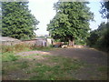
Riding stables at North Cray
A footpath leading up from North Cray Road to Mount Mascal passes through these stables. Horses are in the fields all around and this part of Bexley's Green Belt is very much 'horseyculture' territory.
Image: © Marathon
Taken: 24 Jul 2010
0.21 miles
9
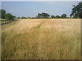
Footpath near Home Close Farm, North Cray
Little Mascal Farm is in the background of this view of the Green Belt countryside in the Borough of Bexley. The footpath leads from North Cray Road to Mount Mascal Farm Riding Stables.
Image: © Marathon
Taken: 24 Jul 2010
0.21 miles
10

The White Cross, North Cray Road
The White Cross dates back to at least 1729 and was once known as the Red Cross Inn. However, before the Second World War the War Office ruled that the name violated the terms of the Geneva Convention protecting the symbols of the International Red Cross Society so the name was changed. The other significant change is that whereas the road in front of it would once have been a quiet country lane, it is now a very busy dual carriageway - the photograph is taken from the central reservation.
Image: © Marathon
Taken: 24 Jul 2010
0.21 miles