IMAGES TAKEN NEAR TO
Hatherley Road, SIDCUP, DA14 4BD
Introduction
This page details the photographs taken nearby to Hatherley Road, DA14 4BD by members of the Geograph project.
The Geograph project started in 2005 with the aim of publishing, organising and preserving representative images for every square kilometre of Great Britain, Ireland and the Isle of Man.

There are currently over 7.5m images from over14,400 individuals and you can help contribute to the project by visiting https://www.geograph.org.uk
Image Map
Images are licensed for reuse under creativecommons.org/licenses/by-sa/2.0
Notes
- Clicking on the map will re-center to the selected point.
- The higher the marker number, the further away the image location is from the centre of the postcode.
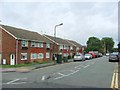
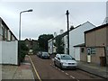
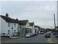
Image Listing (57 Images Found)
Images are licensed for reuse under creativecommons.org/licenses/by-sa/2.0
Image
Details
Distance
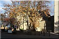
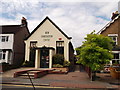
3
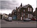
Birkbeck College, Sidcup
On the junction of Birkbeck Road (in front) and Clarence Crescent (on the left).
Image: © David Anstiss
Taken: 14 Aug 2011
0.07 miles
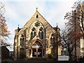
8
Emmanuel Church, Sidcup
On the junction of Hadlow Road (in front) and Granville Road (unseen, to the right).
Image: © David Anstiss
Taken: 14 Aug 2011
0.11 miles
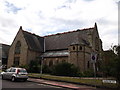
9
New Generation Trust, Sidcup
Church on Birkbeck Road.
Image: © David Anstiss
Taken: 14 Aug 2011
0.11 miles
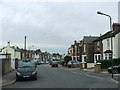
10
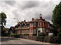
Bird College, Sidcup
Drama, music and theatre college on the junction of Station Road (on the left) and Victoria Road (on the right).
Image: © David Anstiss
Taken: 14 Aug 2011
0.12 miles