1
Railway bridge over the Weaver in Nantwich
The railway is the former LNWR line from Crewe to Shrewsbury. The GWR branch to Market Drayton came off just to the west (left) of here. The people in the photo are walking on the Nantwich Riverside Loop path.
Image: © Stephen Craven
Taken: 27 Sep 2015
0.07 miles
2
Shrewbridge Villas, SW Nantwich
Terrace of Victorian/Edwardian 'villas' immediately north of the level crossing on Shrewbridge Road; probably amongst the oldest houses in the gridsquare. The half-tiled open porches visible here are common in houses of this era in Nantwich and Crewe, although many have been altered. The street in the foreground lies on the boundary with
Image
Image: © Espresso Addict
Taken: 3 Oct 2006
0.07 miles
3
Railway bridge over the River Weaver, Nantwich
Image: © Christopher Hilton
Taken: 20 Feb 2021
0.07 miles
4
Brookfield recreational ground
Bounded by Wellington Road (right), Shrewbridge Road and the railway (beyond the line of poplars), the Brookfield recreational ground has playing fields and a small playground. On the horizon (centre) is St Mary's, the parish church of Nantwich, whose tower dominates Nantwich centre (in
Image)
Image: © Espresso Addict
Taken: 3 Oct 2006
0.08 miles
5
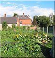
Sunflowers at Brookfield allotments
The allotments by Brookfield recreational ground back onto Wellington Road (part of the A530). The red-brick house in the background is one of the large Victorian/Edwardian houses lining that road; its tower is just visible
Image: © Espresso Addict
Taken: 3 Oct 2006
0.08 miles
6
View towards Nantwich station
View east along the railway line at the Shrewbridge Road level crossing, towards the Wellington Road level crossing and Nantwich station. Brookfield recreational ground lies beyond the line of poplars (right)
Image: © Espresso Addict
Taken: 3 Oct 2006
0.09 miles
7
Memorial to US airman
1st Lieutenant Arthur L Brown of the USAAF, while engaged in high-altitude flying to test oxygen equipment, crashed his Thunderbolt on this spot on the banks of the Weaver on 14 January 1944, avoiding Nantwich town centre. The plane was buried and was not recoverable. This memorial was erected in 1994, and reads:
"Here lies 1st Lieutenant/ Arthur L. Brown/ U.S.A.A.F./ aged 23 years/ of New York/ who crashed/ in his Thunderbolt/ to avoid this town/ Jan. 14th 1944/ With sympathy and respect"
For more information: http://www.pmsa.org.uk/pmsa-database/5071/
Image: © Espresso Addict
Taken: 3 Oct 2006
0.09 miles
8
Ducks by the pedestrian bridge
Close up of the pedestrian/cycle bridge over the River Weaver, by Queens Drive Meadows
Image: © Espresso Addict
Taken: 9 Oct 2006
0.12 miles
9
River Weaver at Queens Drive Meadows
View north from the pedestrian/cycle bridge. One of the several cycle paths on Queens Drive Meadows is visible on the left
Image: © Espresso Addict
Taken: 3 Oct 2006
0.12 miles
10
Cycle path across Queens Drive Meadows
This recreational area between Queens Drive, the railway and the River Weaver is sometimes known as Queens Drive Meadows. The line of willows marks the river, with a pedestrian/cycle bridge visible in centre frame. The houses on left of frame are on Shrewbridge Road, near the boundary with
Image
Image: © Espresso Addict
Taken: 9 Oct 2006
0.12 miles


