IMAGES TAKEN NEAR TO
Turnham Green Drive, CW5 6ZA
Introduction
This page details the photographs taken nearby to Turnham Green Drive, CW5 6ZA by members of the Geograph project.
The Geograph project started in 2005 with the aim of publishing, organising and preserving representative images for every square kilometre of Great Britain, Ireland and the Isle of Man.

There are currently over 7.5m images from over14,400 individuals and you can help contribute to the project by visiting https://www.geograph.org.uk
Image Map (Loading...)


Getting Data...Please wait
Leaflet Map data © OpenStreetMap
Images are licensed for reuse under creativecommons.org/licenses/by-sa/2.0
Notes
- Clicking on the map will re-center to the selected point.
- The higher the marker number, the further away the image location is from the centre of the postcode.
Image Listing (22 Images Found)
Images are licensed for reuse under creativecommons.org/licenses/by-sa/2.0
Image
Details
Distance
2
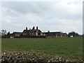
Henhull Hall near Nantwich
It was in this area that saw much of the action during the Civil War battle on or about the 25th January 1644.
Image: © Colin Park
Taken: 7 Mar 2010
0.19 miles
5
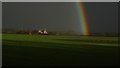
Rainbow towards Henhull Hall near Nantwich
Image: © Colin Park
Taken: 28 Jan 2017
0.20 miles
6
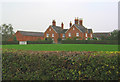
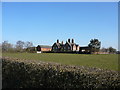
Henhull Farm, near Nantwich
Large red-brick dairy farm, situated north west of Nantwich. View from Welshmen's Lane
Image: © Espresso Addict
Taken: 16 Oct 2006
0.21 miles
8
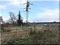
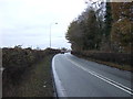
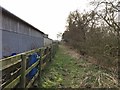
Footpath past Reaseheath Equestrian Centre
Stile on Worleston FP3. To the right beyond the power lines is the dressage arena and the back of the indoor arena seen in http://www.geograph.org.uk/photo/4315053 and http://www.geograph.org.uk/photo/4315032.
Image: © Jonathan Hutchins
Taken: 15 Mar 2015
0.22 miles
9
Footpath past Reaseheath Equestrian Centre
Path is designated Worleston FP3.
Image: © Jonathan Hutchins
Taken: 15 Mar 2015
0.22 miles
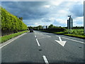
10
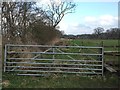
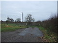
Unused farm track
This track between fields is clearly visible on maps running SSE from the A51 Chester Road towards Nantwich. On the ground it is mostly choked with vegetation. Below and immediately behind this gate can be seen an overgrown cattle grid.
Image: © Jonathan Hutchins
Taken: 15 Mar 2015
0.22 miles