IMAGES TAKEN NEAR TO
Olney Place, NANTWICH, CW5 6XU
Introduction
This page details the photographs taken nearby to Olney Place, CW5 6XU by members of the Geograph project.
The Geograph project started in 2005 with the aim of publishing, organising and preserving representative images for every square kilometre of Great Britain, Ireland and the Isle of Man.

There are currently over 7.5m images from over14,400 individuals and you can help contribute to the project by visiting https://www.geograph.org.uk
Image Map
Images are licensed for reuse under creativecommons.org/licenses/by-sa/2.0
Notes
- Clicking on the map will re-center to the selected point.
- The higher the marker number, the further away the image location is from the centre of the postcode.
Image Listing (23 Images Found)
Images are licensed for reuse under creativecommons.org/licenses/by-sa/2.0
Image
Details
Distance
1
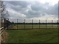
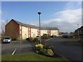
Malbank School & Sixth Form College sports facilities
Image: © Jonathan Hutchins
Taken: 15 Mar 2015
0.15 miles
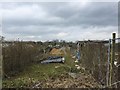
2
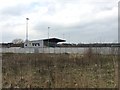
Nantwich: Weaver Stadium
As seen from Henhull FP4. The Weaver Stadium is the home of Nantwich Town FC, who play in the Evo-Stik League.
Image: © Jonathan Hutchins
Taken: 15 Mar 2015
0.17 miles
3
Nantwich: Weaver Stadium
The Weaver Stadium is the home of Nantwich Town FC, who play in the Evo-Stik League. The Weaver is the river which runs through Nantwich.
Image: © Jonathan Hutchins
Taken: 15 Mar 2015
0.17 miles
4
Diverted footpath north of Nantwich
The wooden kissing-gate in the hedge on the right marks the point at which the official footpath route enters the green lane.
Image: © Jonathan Hutchins
Taken: 15 Mar 2015
0.17 miles
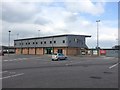
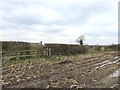
5
Nantwich: Welshmen's Lane allotments
Image: © Jonathan Hutchins
Taken: 15 Mar 2015
0.18 miles
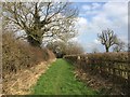
6
Footpath off Welshmen's Lane
Northern terminus of Henhull FP3. The path is diverted around rather than across the maize field.
Image: © Jonathan Hutchins
Taken: 15 Mar 2015
0.18 miles
7
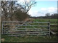
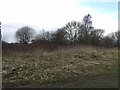
Unused farm track
This track between fields is clearly visible on maps running SSE from the A51 Chester Road towards Nantwich. On the ground it is mostly choked with vegetation. Below and immediately behind this gate can be seen an overgrown cattle grid.
Image: © Jonathan Hutchins
Taken: 15 Mar 2015
0.19 miles
8
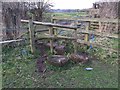
Stile on Henhull FP4
The tree trunks appear to have grown in situ, implying the stile was constructed over and around them.
Image: © Jonathan Hutchins
Taken: 15 Mar 2015
0.19 miles
10
Kingsleyfield Farm (site of)
The current 2.5" OS map shows two small buildings here labelled 'Kingsleyfield Farm'. Nothing remains except some scanty footings.
Image: © Jonathan Hutchins
Taken: 15 Mar 2015
0.20 miles