1
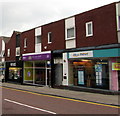
Three High Street shops, Nantwich
Hays Travel, Polka Dot Travel and Regis hairdressers.
Image: © Jaggery
Taken: 13 Oct 2016
0.01 miles
2
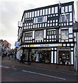
Harrisons Cafe Bar and Lounge, Nantwich
At 1-7 High Street, viewed from the corner of the B5341 Waterlode.
Image: © Jaggery
Taken: 13 Oct 2016
0.01 miles
3
High Street, Nantwich ? 1963
Looking down towards Nantwich Bridge. Still forming part of the A51 through the town, as part of a one-way system, although through traffic was routed via Millstone Lane and Beam Bridge. Today this is the start of the town centre pedestrianised zone.
Image: © Alan Murray-Rust
Taken: 15 Sep 1963
0.01 miles
4
From Oatmarket into Swinemarket - Nantwich, Cheshire
Many old black and white buildings exist in Nantwich, a town which was rebuilt after a serious fire in December 1583. So too do many of the names of the streets as in this example, which give a hint of their past uses. Time taken 1.14 pm BST (British Summer Time).
Image: © Martin Richard Phelan
Taken: 4 May 2013
0.02 miles
5
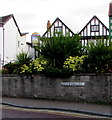
Swine Market name sign, Nantwich
For about 60 metres, from High Street in the southwest to Beam Street in the northeast, the road named Swine Market is parallel with the road named Oat Market, behind the wall. The Talbot pub http://www.geograph.org.uk/photo/5172446 in Oat Market is in the background.
Image: © Jaggery
Taken: 26 Oct 2016
0.02 miles
6
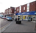
Boots pharmacy and beauty, Nantwich
Town centre shop at 14 Swine Market.
Image: © Jaggery
Taken: 26 Oct 2016
0.02 miles
7
High Street at Nantwich
Looking into High Street from its junction with Water-Lode [B5341].
Image: © M J Richardson
Taken: 21 Sep 2013
0.02 miles
8
Hope House charity shop in Nantwich
At 14 High Street, opposite Swine Market. Proceeds from the sale of donated
items here help fund the work of the Hope House Children's Hospices.
Image: © Jaggery
Taken: 26 Oct 2016
0.02 miles
9
Nantwich Town Centre
There are many half-timbered buildings in Nantwich
Image: © Eirian Evans
Taken: 27 Jul 2012
0.02 miles
10
Harrisons Pub, Nantwich
High Street NANTWICH CW5 5AW close to The Shropshire Union Canal
Image: © canalandriversidepubs co uk
Taken: 14 Jun 2010
0.02 miles


