IMAGES TAKEN NEAR TO
Fuchsia Way, CREWE, CW4 7GN
Introduction
This page details the photographs taken nearby to Fuchsia Way, CW4 7GN by members of the Geograph project.
The Geograph project started in 2005 with the aim of publishing, organising and preserving representative images for every square kilometre of Great Britain, Ireland and the Isle of Man.

There are currently over 7.5m images from over14,400 individuals and you can help contribute to the project by visiting https://www.geograph.org.uk
Image Map
Images are licensed for reuse under creativecommons.org/licenses/by-sa/2.0
Notes
- Clicking on the map will re-center to the selected point.
- The higher the marker number, the further away the image location is from the centre of the postcode.
Image Listing (11 Images Found)
Images are licensed for reuse under creativecommons.org/licenses/by-sa/2.0
Image
Details
Distance
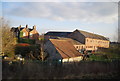

8
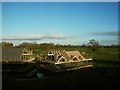
New houses being built near Holmes Chapel
Housing starting to encroach on the green belt east of the railway line.
Image: © Stephen Craven
Taken: 17 Apr 2016
0.23 miles
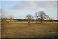
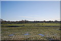
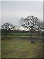
10

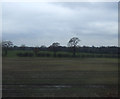
Cheshire farmland south of Holme Chapel
Image: © N Chadwick
Taken: 22 Dec 2019
0.24 miles