
IMAGES TAKEN NEAR TO
Nightshade Place, CREWE, CW4 7GE
Introduction
This page details the photographs taken nearby to Nightshade Place, CW4 7GE by members of the Geograph project.
The Geograph project started in 2005 with the aim of publishing, organising and preserving representative images for every square kilometre of Great Britain, Ireland and the Isle of Man.

There are currently over 7.5m images from over14,400 individuals and you can help contribute to the project by visiting https://www.geograph.org.uk
Image Map
Images are licensed for reuse under creativecommons.org/licenses/by-sa/2.0
Notes
- Clicking on the map will re-center to the selected point.
- The higher the marker number, the further away the image location is from the centre of the postcode.
Image Listing (14 Images Found)
Images are licensed for reuse under creativecommons.org/licenses/by-sa/2.0
Image
Details
Distance
1
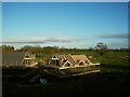
New houses being built near Holmes Chapel
Housing starting to encroach on the green belt east of the railway line.
Image: © Stephen Craven
Taken: 17 Apr 2016
0.15 miles
2
New houses being built near Holmes Chapel (2)
Housing starting to encroach on the green belt east of the railway line.
Image: © Stephen Craven
Taken: 17 Apr 2016
0.16 miles
5
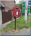
Elizabeth II postbox, Alum Court
Image: © JThomas
Taken: 11 Jun 2016
0.18 miles
6
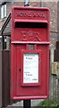
Close up, Elizabeth II postbox, Alum Court
Postbox No. CW4 296.
See Image] for wider view.
Image: © JThomas
Taken: 11 Jun 2016
0.18 miles
7
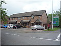
Houses, Alum Court
Showing position of Postbox No. CW4 296.
See Image] for postbox
Image: © JThomas
Taken: 11 Jun 2016
0.18 miles
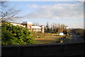
10
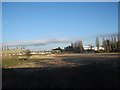
Former Fisons site, Holmes Chapel
The former Bengers pharmaceutical works (Fisons from 1947, Rhone-Poulenc from 1995) was a major employer in the area. Production ceased in 2005 and the works were demolished over the last few years. Unfortunately we seem not to have any photos of the buildings on this site except for a glimpse of the office block Image taken in 2013.
Image: © Stephen Craven
Taken: 17 Apr 2016
0.23 miles