IMAGES TAKEN NEAR TO
College Close, CREWE, CW3 9HQ
Introduction
This page details the photographs taken nearby to College Close, CW3 9HQ by members of the Geograph project.
The Geograph project started in 2005 with the aim of publishing, organising and preserving representative images for every square kilometre of Great Britain, Ireland and the Isle of Man.

There are currently over 7.5m images from over14,400 individuals and you can help contribute to the project by visiting https://www.geograph.org.uk
Image Map
Images are licensed for reuse under creativecommons.org/licenses/by-sa/2.0
Notes
- Clicking on the map will re-center to the selected point.
- The higher the marker number, the further away the image location is from the centre of the postcode.
Image Listing (20 Images Found)
Images are licensed for reuse under creativecommons.org/licenses/by-sa/2.0
Image
Details
Distance
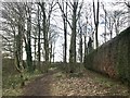
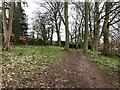
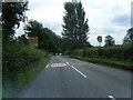
1
Heighley Castleway
This estate road is designated as a public footpath.
Image: © Glyn Baker
Taken: 29 Aug 2014
0.04 miles
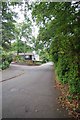
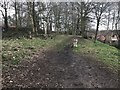
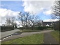
2
Road and path junction in Madeley
Heighley Castle Way bears away to the left. Both roads are routes of public footpaths.
Image: © Jonathan Hutchins
Taken: 16 Mar 2018
0.06 miles
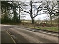
6
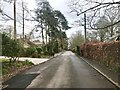
Heighley Castle Way
The road is also the route of a public footpath.
Image: © Jonathan Hutchins
Taken: 16 Mar 2018
0.08 miles
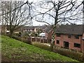
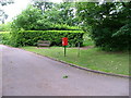
9
Junction of Heighley Castle Way and New Road, Madeley
Image: © Jonathan Hutchins
Taken: 16 Mar 2018
0.12 miles