
IMAGES TAKEN NEAR TO
Furnace Lane, CREWE, CW3 9EU
Introduction
This page details the photographs taken nearby to Furnace Lane, CW3 9EU by members of the Geograph project.
The Geograph project started in 2005 with the aim of publishing, organising and preserving representative images for every square kilometre of Great Britain, Ireland and the Isle of Man.

There are currently over 7.5m images from over14,400 individuals and you can help contribute to the project by visiting https://www.geograph.org.uk
Image Map
Images are licensed for reuse under creativecommons.org/licenses/by-sa/2.0
Notes
- Clicking on the map will re-center to the selected point.
- The higher the marker number, the further away the image location is from the centre of the postcode.
Image Listing (44 Images Found)
Images are licensed for reuse under creativecommons.org/licenses/by-sa/2.0
Image
Details
Distance
1
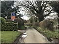
Furnace Lane
The red sign reads:
NO ACCESS TO
N.W.W. SITE
USE MOSS LANE
N.W.W. stands for North West Water, a water supply company which merged with another company to form United Utilities in 1995 - hence the sign is over twenty years old - and the 'site' is the local sewage works.
Image: © Jonathan Hutchins
Taken: 16 Mar 2018
0.02 miles
2

Care home in Madeley
Lea Court is an extra care facility with 63 two-bedroom apartments.
Image: © Jonathan Hutchins
Taken: 16 Mar 2018
0.07 miles
4
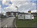
Lea Court and The Madeley Centre
Lea Court is an extra care facility with 63 two-bedroom apartments, attached to The Madeley Centre, a large community centre.
Image: © Jonathan Hutchins
Taken: 16 Mar 2018
0.12 miles
5
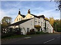
Madeley Mill
During its history the mill was used for grinding grain but prior to its closure, production was turned over to cheese making. It fell into disrepair before being developed and converted into apartments in the early 1990s saving it from proposed demolition by the local council.
Image: © Jonathan Hutchins
Taken: 31 Oct 2016
0.12 miles
6
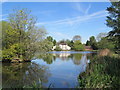
Madeley Mill and Pool
Looking across the pool towards Madeley Mill, a former watermill now converted into flats.
Image: © David Weston
Taken: 15 May 2019
0.12 miles
10
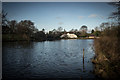
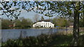
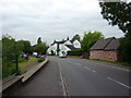
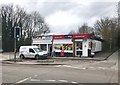
Madeley Pond and Mill (Now Flats)
Madeley Pool looking North towards Madeley Mill. During its history the mill was used for grinding grain but prior to its closure, production was turned over to cheese making. It fell into disrepair before being developed and converted into apartments in the early 1990s saving it from proposed demolition by the local council.
https://en.wikipedia.org/wiki/Madeley,_Staffordshire
Image: © Brian Deegan
Taken: 4 Jan 2020
0.13 miles