
IMAGES TAKEN NEAR TO
Shropshire Street, CREWE, CW3 0AG
Introduction
This page details the photographs taken nearby to Shropshire Street, CW3 0AG by members of the Geograph project.
The Geograph project started in 2005 with the aim of publishing, organising and preserving representative images for every square kilometre of Great Britain, Ireland and the Isle of Man.

There are currently over 7.5m images from over14,400 individuals and you can help contribute to the project by visiting https://www.geograph.org.uk
Image Map
Images are licensed for reuse under creativecommons.org/licenses/by-sa/2.0
Notes
- Clicking on the map will re-center to the selected point.
- The higher the marker number, the further away the image location is from the centre of the postcode.
Image Listing (250 Images Found)
Images are licensed for reuse under creativecommons.org/licenses/by-sa/2.0
Image
Details
Distance

4
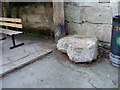
The Bear Stone, Audlem
This granite stone was originally in the centre of the town square. It has an iron ring and was used for bear baiting. It is now next to the Butter Market and the walls of the church.
Image: © Eirian Evans
Taken: 5 Aug 2008
0.01 miles
5
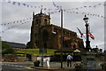
Audlem: The Square en f?te, Summer 2012
The bunting is presumably to do with the Diamond Jubilee earlier in the year, although the Olympics may also be a factor.
In the centre of The Square, the monument to 19th century doctor Richard Baker Bellyse ("a man he was to all the country dear"); behind it, the Butter Market and the church of St James the Great.
Audlem's position at the meeting point of various counties is indicated by the street names: Cheshire Street leads off to the left, deeper into the county that the village lies in, whilst the road to the right is Stafford Street and Shropshire Street lies behind the camera. (Due to a peculiarity of the boundaries that sees Shropshire stretch up a peninsula around Woore, the first county boundary that Stafford Street reaches actually takes one into Shropshire, but beyond Woore one soon enters Staffordshire and the fringes of the Potteries.)
Image: © Christopher Hilton
Taken: 17 Aug 2012
0.01 miles
6
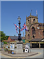
Memorial and church in Audlem in Cheshire
The memorial street lamp at the junction of Shropshire Street, Cheshire Street and Stafford Street in Audlem is inscribed:
IN MEMORY OF
RICHARD BAKER BELLYSE
WHO PRACTISED AS A SURGEON
IN THIS TOWN FOR 40 YEARS
BORN 17TH MAY 1809
DIED 11 JANUARY 1877
To the rear is part of St James's Church.
Image: © Roger Kidd
Taken: 7 Jun 2018
0.01 miles

8
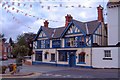
The Lord Combermere PH, Audlem
The Lord Combermere pub at the corner of Cheshire Street (A529) and Stafford Street (A525) in the centre of Audlem. Flags for the World Cup or the local fete?
Image: © Mike Harris
Taken: 21 Jun 2006
0.02 miles
9
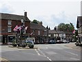
Audlem
Rather a lot of union flags knocking about here. I don't think I have ever seen so many, not even in Northern Ireland. They have however left the kerbstones alone.
Image: © Richard Webb
Taken: 2 Jul 2014
0.02 miles
10
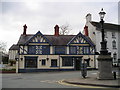
The Lord Combermere Pub, Audlem
The Square, Audlem CREWE CW3 0AG close to The Shropshire Union Canal
Image: © canalandriversidepubs co uk
Taken: 15 Apr 2010
0.02 miles