
IMAGES TAKEN NEAR TO
Penbrook Close, CREWE, CW2 8UD
Introduction
This page details the photographs taken nearby to Penbrook Close, CW2 8UD by members of the Geograph project.
The Geograph project started in 2005 with the aim of publishing, organising and preserving representative images for every square kilometre of Great Britain, Ireland and the Isle of Man.

There are currently over 7.5m images from over14,400 individuals and you can help contribute to the project by visiting https://www.geograph.org.uk
Image Map
Images are licensed for reuse under creativecommons.org/licenses/by-sa/2.0
Notes
- Clicking on the map will re-center to the selected point.
- The higher the marker number, the further away the image location is from the centre of the postcode.
Image Listing (8 Images Found)
Images are licensed for reuse under creativecommons.org/licenses/by-sa/2.0
Image
Details
Distance
1
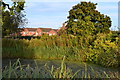
Pond beside Coppenhall Lane
In the grounds of the Premier Inn hotel.
Image: © David Martin
Taken: 14 Sep 2019
0.16 miles
2
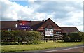
Premier Inn Crewe
The Farmhouse Premier Inn Crewe. Beefeater restaurant next door.
Image: © Margaret Sutton
Taken: 11 Apr 2008
0.16 miles
3
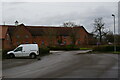
Crewe West Premier Inn, Marshfield Bank, Crewe
Image: © Christopher Hilton
Taken: 20 Feb 2021
0.19 miles
4
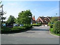
Entrance drive to Crewe West Premier Inn, Woolstanwood
The entrance drive to the car park off Coppenhall Lane. This Premier Inn has a Farmhouse Beefeater restaurant attached to it.
Image: © David P Howard
Taken: 1 Sep 2010
0.19 miles
5
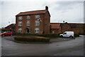
The Cottage, Crewe West Premier Inn, Marshfield Bank
The building in the foreground, a typical late-18th / early 19th century red-brick Cheshire farmhouse, is completely surrounded by the car parks of Crewe West Premier Inn. It carries the name "The Cottage"; whether it has any connection with the Premier Inn is not clear to the outsider. It would originally have stood in a wedge of land between the main Nantwich-Middlewich road (to the left) and Coppenhall Lane (behind the camera - now diverted to run behind the house to a new road junction).
Image: © Christopher Hilton
Taken: 20 Feb 2021
0.19 miles
6
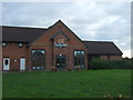
The Beefeater public house, Marshfield Bank
Next to the Premier Inn.
Image: © JThomas
Taken: 5 Nov 2016
0.20 miles
7
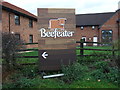
Sign for the Beefeater public house, Marshfield Bank
Image: © JThomas
Taken: 5 Nov 2016
0.21 miles
8
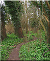
Woodland near Marshfield Bridge
A footpath (not a right of way) winds through a small strip of woodland between Valley Brook and Middlewich Road (A530). The ground is carpeted with pungent wild garlic (Allium ursinum), which is very common in this area. Despite the close proximity of a new housing estate, still a peaceful location
Image: © Espresso Addict
Taken: 13 Mar 2007
0.22 miles