
IMAGES TAKEN NEAR TO
Grasmere Avenue, CREWE, CW2 8SQ
Introduction
This page details the photographs taken nearby to Grasmere Avenue, CW2 8SQ by members of the Geograph project.
The Geograph project started in 2005 with the aim of publishing, organising and preserving representative images for every square kilometre of Great Britain, Ireland and the Isle of Man.

There are currently over 7.5m images from over14,400 individuals and you can help contribute to the project by visiting https://www.geograph.org.uk
Image Map
Images are licensed for reuse under creativecommons.org/licenses/by-sa/2.0
Notes
- Clicking on the map will re-center to the selected point.
- The higher the marker number, the further away the image location is from the centre of the postcode.
Image Listing (37 Images Found)
Images are licensed for reuse under creativecommons.org/licenses/by-sa/2.0
Image
Details
Distance
1
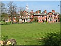
Webb Orphanage
The orphanage dates from 1909 set up under the will of Francis William Webb, Chief Mechanical Engineer of the London and North Western Railway Company for children of LNWR employees and designed by architect John Brooke. The home could accommodate eighty children. As conditions and safety improved by 1958 there were only two orphans. After use as an NHS facility the building is on the market at £1.3M.
During the First World War the East Wing was used as an auxiliary hospital.
Image: © John M
Taken: 9 Apr 2017
0.09 miles
2
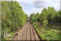
Railway into Crewe
Looking ESE from the West Street bridge over the railway line from Chester towards the centre of Crewe. This is one of the non electrified lines.
Image: © David P Howard
Taken: 11 May 2012
0.09 miles
3
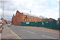
Crewe Works, West Street
One of the remaining factory buildings that once was the massive Crewe railway works. http://en.wikipedia.org/wiki/Crewe_Works
The factory is now owned by the Canadian engineering company Bombardier.
Image: © David P Howard
Taken: 11 May 2012
0.11 miles
4
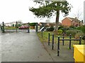
Queen's Park - west gates
There is a cycle rack at this, as well as the east entrance.
Image: © Stephen Craven
Taken: 30 Dec 2022
0.14 miles
5
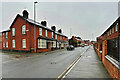
Crewe, West Street
There is a row of predominantly brick-built terraced houses, possibly of Victorian or Edwardian style, on the far side of the road. These houses contrast with the newer housing on the near side of the road.
Image: © David Dixon
Taken: 28 Dec 2024
0.16 miles
6
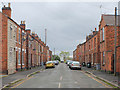
Hulme Street
Looking north along Hulme Street from its junction with West Street.
Image: © David P Howard
Taken: 11 May 2012
0.17 miles
9
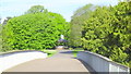
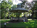
Bandstand at west side of Queen's park
Over new bridge from close to war memorial
Image: © Garry Lavender-Rimmer
Taken: 21 May 2015
0.18 miles
10
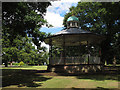
Queen's Park: bandstand
At the western end of the park.
Image: © Stephen Craven
Taken: 19 Jul 2015
0.18 miles