
IMAGES TAKEN NEAR TO
Glendale Close, CREWE, CW2 8QE
Introduction
This page details the photographs taken nearby to Glendale Close, CW2 8QE by members of the Geograph project.
The Geograph project started in 2005 with the aim of publishing, organising and preserving representative images for every square kilometre of Great Britain, Ireland and the Isle of Man.

There are currently over 7.5m images from over14,400 individuals and you can help contribute to the project by visiting https://www.geograph.org.uk
Image Map
Images are licensed for reuse under creativecommons.org/licenses/by-sa/2.0
Notes
- Clicking on the map will re-center to the selected point.
- The higher the marker number, the further away the image location is from the centre of the postcode.
Image Listing (17 Images Found)
Images are licensed for reuse under creativecommons.org/licenses/by-sa/2.0
Image
Details
Distance
1
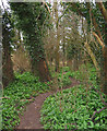
Woodland near Marshfield Bridge
A footpath (not a right of way) winds through a small strip of woodland between Valley Brook and Middlewich Road (A530). The ground is carpeted with pungent wild garlic (Allium ursinum), which is very common in this area. Despite the close proximity of a new housing estate, still a peaceful location
Image: © Espresso Addict
Taken: 13 Mar 2007
0.16 miles
2
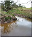
Wistaston Brook, east of Marshfield Bridge
Wistaston Brook flows relatively deep and slow at this point, immediately after the split from Valley Brook east of Marshfield Bridge. The banks are clothed with wild garlic (Allium ursinum), which is very common in this area. Despite a new housing estate nearby, this remains a peaceful spot
Image: © Espresso Addict
Taken: 13 Mar 2007
0.18 miles
3
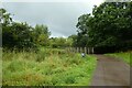
Bridge crossing Valley Brook
The path is part of National Cycle Network route 451.
Image: © DS Pugh
Taken: 6 Aug 2023
0.19 miles
4
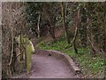
Wistaston Walks
This is at the other side of the Golden Jubilee Bridge where the walk heads for the Middlewich Road then Queen's Park, Crewe.
Image: © Terry Hughes
Taken: 19 Mar 2010
0.19 miles
5
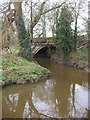
Marshfield Bridge over Valley Brook
A sandstone roadbridge carries the busy Middlewich Road (A530) over Valley Brook. The brook splits into two a few metres from this point. The banks are clothed with wild garlic (Allium ursinum), which is very common in this area
Image: © Espresso Addict
Taken: 13 Mar 2007
0.20 miles
7
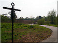
New Greenway
This is the new section of the Crewe - Nantwich Greenway looking towards Wistaston Green Road and the Middlewich Road.
Image: © Terry Hughes
Taken: 22 Apr 2011
0.21 miles
8
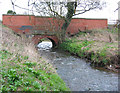
Wistaston Green Bridge
The north-west side of a red-and-purple brick roadbridge over Wistaston Brook, just outside Wistaston Green. The bridge is dated 1787 on a foundation stone on the south side, where the pedestrian Golden Jubilee Bridge runs alongside. The plants in the foreground are wild garlic (Allium ursinum), which is very common around the banks of both Valley and Wistaston brooks in this area. See also Image
Image: © Espresso Addict
Taken: 13 Mar 2007
0.22 miles
9
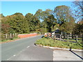
Wistaston Green Road, Crewe
Looking towards the bridges over Wistaston Brook
Image: © Margaret Sutton
Taken: 25 Oct 2010
0.22 miles
10
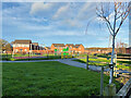
Kingfisher Reach Play Area, Wistaston Green
Image: © David Dixon
Taken: 30 Dec 2024
0.22 miles