IMAGES TAKEN NEAR TO
Spencer Close, CREWE, CW2 8DT

Introduction

This page details the photographs taken nearby to Spencer Close, CW2 8DT by members of the Geograph project.

The Geograph project started in 2005 with the aim of publishing, organising and preserving representative images for every square kilometre of Great Britain, Ireland and the Isle of Man.

There are currently over 7.5m images from over14,400 individuals and you can help contribute to the project by visiting https://www.geograph.org.uk

Image Map


Images are licensed for reuse under creativecommons.org/licenses/by-sa/2.0
Notes
  • Clicking on the map will re-center to the selected point.
  • The higher the marker number, the further away the image location is from the centre of the postcode.

Image Listing (10 Images Found)

Images are licensed for reuse under creativecommons.org/licenses/by-sa/2.0
Image
Details
Distance
1
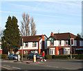
House on the A534, Crewe
Image: © JThomas Taken: 3 Dec 2016
0.10 miles
2
NEW Crewe Road
The main (A534) road towards Crewe centre.
Image: © David Dixon Taken: 30 Dec 2024
0.11 miles
3
Bus stop on Crewe Road (A534)
Image: © JThomas Taken: 3 Dec 2016
0.11 miles
4
Old Milepost by the A534, Crewe Road, Wistaston
Cast iron post by the A534, in parish of Wistaston (Crewe and Nantwich District), Crewe Road; midway between Broughton Lane and Laidon Avenue junctions, in pavement, back to hedge, on North West side of road. Cast iron CCC1898, erected by the County Council in the 19th century. Inscription reads:- : CREWE 1 / HASLINGTON 3 / WHEELOCK 5½ / SANDBACH 7 / CONGLETON 14 : : CHESHIRE / 1898 / COUNTY COUNCIL : : NANTWICH / 3 MILES / WHITCHURCH 14 : Maker:- : W H SMITH & CO / MAKERS / WHITCHURCH : Cheshire HER. SMR Number: 5487 https://www.heritagegateway.org.uk/Gateway/Results_Single.aspx?uid=MCH16450&resourceID=1004 Milestone Society National ID: CH_NWCO03
Image: © J Higgins Taken: 1 Mar 2004
0.17 miles
5
Semis on Berkeley Crescent, Wistaston
Semi-detached houses, c.1950s, on Berkeley Crescent. Typical of the older housing near the A534 in this square and adjacent ones
Image: © Espresso Addict Taken: 21 Mar 2007
0.18 miles
6
Church of Jesus Christ of Latter-day Saints, Crewe
Image: © JThomas Taken: 3 Dec 2016
0.18 miles
7
George VI postbox on Crewe Road
Postbox No. CW2 60. See Image] for context.
Image: © JThomas Taken: 3 Dec 2016
0.19 miles
8
Crewe Road (A534)
Showing position of Postbox No. CW2 60. See Image] for postbox.
Image: © JThomas Taken: 3 Dec 2016
0.19 miles
9
NEW Park Drive, Wells Green
Image: © David Dixon Taken: 30 Dec 2024
0.22 miles
10
Wells Green traffic lights, Wistaston
Traffic lights at the junction between Crewe Road (A534) and Brookland Avenue/Rope Lane. The c.1950s houses lining Crewe Road are typical of the older houses in this square
Image: © Espresso Addict Taken: 21 Mar 2007
0.24 miles