IMAGES TAKEN NEAR TO
Wistaston Road, CREWE, CW2 7RE

Introduction

This page details the photographs taken nearby to Wistaston Road, CW2 7RE by members of the Geograph project.

The Geograph project started in 2005 with the aim of publishing, organising and preserving representative images for every square kilometre of Great Britain, Ireland and the Isle of Man.

There are currently over 7.5m images from over14,400 individuals and you can help contribute to the project by visiting https://www.geograph.org.uk

Image Map


Images are licensed for reuse under creativecommons.org/licenses/by-sa/2.0
Notes
  • Clicking on the map will re-center to the selected point.
  • The higher the marker number, the further away the image location is from the centre of the postcode.

Image Listing (154 Images Found)

Images are licensed for reuse under creativecommons.org/licenses/by-sa/2.0
  • ...
Image
Details
Distance
1
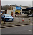
Brookhouse Garage vehicle test centre, Wistaston Road, Crewe
The sign shows Department of Transport Approved vehicle test centre.
Image: © Jaggery Taken: 15 Feb 2017
0.02 miles
2
Auto Body Shop, Crewe
Motor accident and insurance repair specialists at 47 Wistaston Road.
Image: © Jaggery Taken: 15 Feb 2017
0.02 miles
3
Duke Street, Crewe
Cul-de-sac on the south side of Wistaston Road.
Image: © Jaggery Taken: 15 Feb 2017
0.02 miles
4
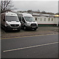
Vans available to rent, Wistaston Road, Crewe
Parked in the Afford Rent-a-Car site.
Image: © Jaggery Taken: 15 Feb 2017
0.03 miles
5
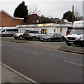
Afford Rent-a-Car, Wistaston Road, Crewe
The name signs use £ for f so that Afford is A££ord.
Image: © Jaggery Taken: 15 Feb 2017
0.03 miles
6
Longman's Butchers shop in Crewe
At 47 Wistaston Road.
Image: © Jaggery Taken: 15 Feb 2017
0.03 miles
7
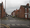
Long row of houses, Wistaston Road, Crewe
Looking east from the corner of Flag Lane in February 2017. An old tablet at first floor level near the lamppost shows WISTASTON TERRACE, a name which does not appear to be in current use.
Image: © Jaggery Taken: 15 Feb 2017
0.04 miles
8
Eastern end of Lewis Street, Crewe
Viewed across Flag Lane. The eastern end of a Lewis Street is a cul-de-sac. The western part of Lewis Street behind the camera leads to Bridle Road.
Image: © Jaggery Taken: 15 Feb 2017
0.05 miles
9
The Park pub in Crewe
Pub at 42 Wistaston Road on the corner of Walthall Street. http://www.geograph.org.uk/photo/5290287 to the name sign
Image: © Jaggery Taken: 15 Feb 2017
0.05 miles
10
The Park pub name sign, Crewe
On the corner here. http://www.geograph.org.uk/photo/5290274
Image: © Jaggery Taken: 15 Feb 2017
0.05 miles
  • ...