
IMAGES TAKEN NEAR TO
Stalbridge Road, CREWE, CW2 7LR
Introduction
This page details the photographs taken nearby to Stalbridge Road, CW2 7LR by members of the Geograph project.
The Geograph project started in 2005 with the aim of publishing, organising and preserving representative images for every square kilometre of Great Britain, Ireland and the Isle of Man.

There are currently over 7.5m images from over14,400 individuals and you can help contribute to the project by visiting https://www.geograph.org.uk
Image Map
Images are licensed for reuse under creativecommons.org/licenses/by-sa/2.0
Notes
- Clicking on the map will re-center to the selected point.
- The higher the marker number, the further away the image location is from the centre of the postcode.
Image Listing (217 Images Found)
Images are licensed for reuse under creativecommons.org/licenses/by-sa/2.0
Image
Details
Distance
1
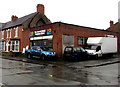
The Second Hand Furniture Store, Crewe
At 7 Stalbridge Road, on the corner of Brooklyn Street.
Image: © Jaggery
Taken: 15 Feb 2017
0.01 miles
2
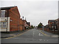
Stalbridge Road, Crewe
Looking west from Edleston Road.
Image: © John Topping
Taken: 6 Jun 2013
0.01 miles
3
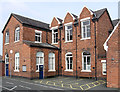
Crewe - former school on Stalbridge Road (from SE)
According to http://cheshireeast-consult.limehouse.co.uk/portal/planning/spd/locallist?pointId=1299169990184 , this is a "Victorian School, constructed in 1875 in red brick. One of a number of schools built after the 1870 Education Act. Well-preserved Victorian facade in an Austere style". According to a sign on the building, this is now "South Cheshire College Administration Centre". The main campus is 0.5mi to the SW. For an alternative view, please see Image
Image: © Dave Bevis
Taken: 4 Mar 2013
0.02 miles
4
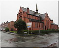
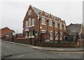
Funsters, Stalbridge Road, Crewe
Children's play & party centre in a former Baptist church on the corner of Stalbridge Road and Brooklyn Street.
Image: © Jaggery
Taken: 15 Feb 2017
0.02 miles
5
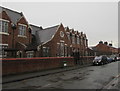
Former school buildings, Derrington Avenue, Crewe
The northern side of a former school. Its southern side is alongside Stalbridge Road.
Image: © Jaggery
Taken: 15 Feb 2017
0.03 miles
6
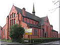
Crewe - former church on Stalbridge Road
Now occupied by "Funsters" - an indoor playground for children.
Image: © Dave Bevis
Taken: 4 Mar 2013
0.03 miles
7

Crewe - former school on Stalbridge Road (from SW)
According to http://cheshireeast-consult.limehouse.co.uk/portal/planning/spd/locallist?pointId=1299169990184 , this is a "Victorian School, constructed in 1875 in red brick. One of a number of schools built after the 1870 Education Act. Well-preserved Victorian facade in an Austere style". According to a sign on the building, this is now "South Cheshire College Administration Centre". The main campus is 0.5mi to the SW. For an alternative view, please see Image
Image: © Dave Bevis
Taken: 4 Mar 2013
0.03 miles
8
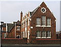
Crewe - former school on Stalbridge Road (from E)
According to http://cheshireeast-consult.limehouse.co.uk/portal/planning/spd/locallist?pointId=1299169990184 , this is a "Victorian School, constructed in 1875 in red brick. One of a number of schools built after the 1870 Education Act. Well-preserved Victorian facade in an Austere style". According to a sign on the building, this is now "South Cheshire College Administration Centre". The main campus is 0.5mi to the SW. For an alternative view, please see Image
Image: © Dave Bevis
Taken: 4 Mar 2013
0.03 miles
9
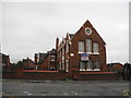
Ex - School, up for sale
Recently used as an administration centre for the South Cheshire College. Edleston Road side view, viewed from Union Street.
Image: © John Topping
Taken: 6 Jun 2013
0.03 miles
10
SOLD board on a former school building, Crewe
On the corner of Derrington Avenue and Edleston Road, viewed in February 2017.
The board states that PP (Planning Permission) has been granted for 10 apartments.
Image: © Jaggery
Taken: 15 Feb 2017
0.03 miles