
IMAGES TAKEN NEAR TO
Lord Street, CREWE, CW2 7DH
Introduction
This page details the photographs taken nearby to Lord Street, CW2 7DH by members of the Geograph project.
The Geograph project started in 2005 with the aim of publishing, organising and preserving representative images for every square kilometre of Great Britain, Ireland and the Isle of Man.

There are currently over 7.5m images from over14,400 individuals and you can help contribute to the project by visiting https://www.geograph.org.uk
Image Map
Images are licensed for reuse under creativecommons.org/licenses/by-sa/2.0
Notes
- Clicking on the map will re-center to the selected point.
- The higher the marker number, the further away the image location is from the centre of the postcode.
Image Listing (315 Images Found)
Images are licensed for reuse under creativecommons.org/licenses/by-sa/2.0
Image
Details
Distance
1
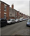
West side of Lord Street, Crewe
Houses on the west side of Lord Street viewed from the corner of Union Street.
Image: © Jaggery
Taken: 15 Feb 2017
0.02 miles
2
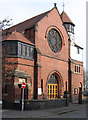
Crewe - Union Street Baptist Church
For an alternative view, please see Image
Image: © Dave Bevis
Taken: 4 Mar 2013
0.03 miles
3
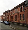
West side of Union Street Baptist Church, Crewe
The Lord Street side of this http://www.geograph.org.uk/photo/5289167 church.
Image: © Jaggery
Taken: 15 Feb 2017
0.03 miles
4
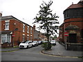
Lord Street, Crewe
Looking north from Union Street.
Image: © John Topping
Taken: 6 Jun 2013
0.03 miles
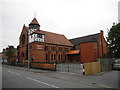
6
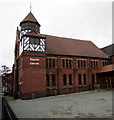
Union Street Baptist Church, Crewe
The east side of the church of the corner of Union Street and Lord Street.
Image: © Jaggery
Taken: 15 Feb 2017
0.04 miles
7

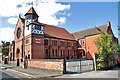
Union Street Baptist Church, Crewe
This Baptist church, tucked away in the web of streets between Crewe's railway station and the town centre, dates from 1884 and was designed by J Wallis Chapman. It was built to serve the large population of railway workers. It is grade II listed but the timber-framed octagonal lantern is a very odd feature that seems architecturally discordant.
Image: © Stephen McKay
Taken: 26 Mar 2026
0.04 miles
9
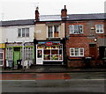
Istanbul in Crewe
Istanbul takeaway (kebabs, fried chicken, burgers, pizzas) is at 161 Edleston Road.
The tablet on the first floor shows BURDETT TERRACE and the year 1881.
Image: © Jaggery
Taken: 15 Feb 2017
0.04 miles
10
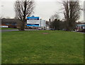
Mill Street Development Site notice, Crewe
In February 2017, the Clowes Developments (North West) Ltd board refers to a currently derelict 10 acre site between Mill Street and Lockitt Street, out of shot on the right. The board states that the site has planning permission for 70,000 square ft of food and non-food retail.
Image: © Jaggery
Taken: 15 Feb 2017
0.04 miles