IMAGES TAKEN NEAR TO
St. Andrews Close, CREWE, CW2 5TL
Introduction
This page details the photographs taken nearby to St. Andrews Close, CW2 5TL by members of the Geograph project.
The Geograph project started in 2005 with the aim of publishing, organising and preserving representative images for every square kilometre of Great Britain, Ireland and the Isle of Man.

There are currently over 7.5m images from over14,400 individuals and you can help contribute to the project by visiting https://www.geograph.org.uk
Image Map (Loading...)


Getting Data...Please wait
Leaflet Map data © OpenStreetMap
Images are licensed for reuse under creativecommons.org/licenses/by-sa/2.0
Notes
- Clicking on the map will re-center to the selected point.
- The higher the marker number, the further away the image location is from the centre of the postcode.
Image Listing (4 Images Found)
Images are licensed for reuse under creativecommons.org/licenses/by-sa/2.0
Image
Details
Distance
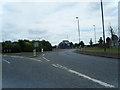
1
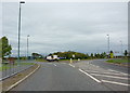
Roundabout on the A531 near Wychwood Park
Image: © Alexander P Kapp
Taken: 13 Sep 2010
0.20 miles
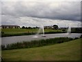
4
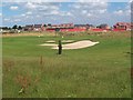
New housing at Wychwood Park
As you drive along the A531 south of Crewe you come across the huge Wychwood development - sprawling over dozens of hectares of the Cheshire countryside. :-(
Image: © Adrian Bailey
Taken: 2 Aug 2005
0.22 miles