IMAGES TAKEN NEAR TO
Derby Street, CONGLETON, CW12 1HZ
Introduction
This page details the photographs taken nearby to Derby Street, CW12 1HZ by members of the Geograph project.
The Geograph project started in 2005 with the aim of publishing, organising and preserving representative images for every square kilometre of Great Britain, Ireland and the Isle of Man.

There are currently over 7.5m images from over14,400 individuals and you can help contribute to the project by visiting https://www.geograph.org.uk
Image Map
Images are licensed for reuse under creativecommons.org/licenses/by-sa/2.0
Notes
- Clicking on the map will re-center to the selected point.
- The higher the marker number, the further away the image location is from the centre of the postcode.
Image Listing (90 Images Found)
Images are licensed for reuse under creativecommons.org/licenses/by-sa/2.0
Image
Details
Distance
1
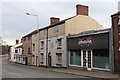
Silk Weavers' Cottage, Congleton
A row of three, three storey weavers' cottages with top storey multi-light loom shops. On Rood Hill by the junction with Royle Street. There are two collections of weavers' cottages within a few hundred yards in Congleton.
Image: © Chris Allen
Taken: 17 Feb 2019
0.05 miles
2
Bridge Mill, Congleton
A former fustian cutting mill. This shows the three storey brick built block of the 1870s. At the far end is a 20th century flat roofed, concrete and steel framed range. This is one of several remaining former silk and cotton mills in Congleton.
Fustian cutting was using a sharp blade to cut through the loops of various types of fabric (usually cotton) to produce the high pile required for velvet, moleskin and corduroy. Between 1860 and 1950 fustian cutting was Congleton's dominant industry and took place in reused silk mills and in new build premises.
Image: © Chris Allen
Taken: 17 Feb 2019
0.05 miles
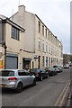
3
Bridge Mill, Congleton
Former fustian cutting mill alongside the River Dane. Brick built three storey range of the 1870s (to the rear in this view) Later 20 the century flat roofed and concrete and steel framed ranges of 2 and three storeys to the west and south.
Image: © Chris Allen
Taken: 17 Feb 2019
0.06 miles
4
Salford Mill, Congleton
Early 19th century silk mill overlooking the River Dane with a central pediment and clock. Now owned by a furnishing company. The wall on the left that incorporates window sills is the demolished Dane Bridge Mill. The bridge over the river is in the foreground. The Mill Chippy is evocative but I've no idea of the quality of the produce.
Image: © Chris Allen
Taken: 17 Feb 2019
0.06 miles
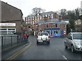
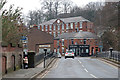
6
Rood Lane, Congleton
The junction of the A34 and A54. Centre-shot was the location of the 1930s "lighthouse", which warned nighttime motorists of this dangerous hill bend.
Image: © Adrian Bailey
Taken: 16 Feb 2005
0.08 miles
7
Site of Dane Bridge Mill
On the left is the River Dane while on the right the wall marks the remains of Dane Bridge Mill with the sills of the ground floor windows visible in the wall. The guide book I have lists this as a former silk mill of 1875 with three storeys and in a ruinous condition. It has obviously been demolished and is now overgrown wasteland. An earlier view is seen here - Image Despite the loss of two large old mills in recent years, Congleton still has many links to its textile past.
Image: © Chris Allen
Taken: 17 Feb 2019
0.08 miles
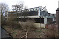
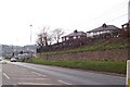
8
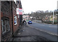
The junction of the A54 with the A34
The road is climbing out of the town away from the River Dane valley.
Image: © Bill Boaden
Taken: 9 Aug 2012
0.08 miles
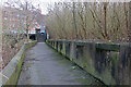
9
The Dane Bridge
Built in 1889 of cast iron with stone buttresses, the Dane Bridge carries the A54 over the River Dane. There is a bench mark on the buttress on the other side of the road from the camera (Image).
Image: © Jonathan Kington
Taken: 13 Mar 2011
0.08 miles
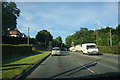
10
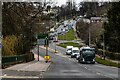
A34
A34 Clayton Bypass look towards Rood Hill in Congleton.
Image: © Peter McDermott
Taken: 6 Mar 2021
0.08 miles