Bridge Mill, Congleton
Introduction
The photograph on this page of Bridge Mill, Congleton by Chris Allen as part of the Geograph project.
The Geograph project started in 2005 with the aim of publishing, organising and preserving representative images for every square kilometre of Great Britain, Ireland and the Isle of Man.

There are currently over 7.5m images from over 14,400 individuals and you can help contribute to the project by visiting https://www.geograph.org.uk
Bridge Mill, Congleton
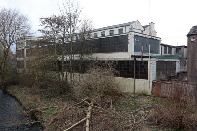
Image: © Chris Allen Taken: 17 Feb 2019
Former fustian cutting mill alongside the River Dane. Brick built three storey range of the 1870s (to the rear in this view) Later 20 the century flat roofed and concrete and steel framed ranges of 2 and three storeys to the west and south.
Images are licensed for reuse under creativecommons.org/licenses/by-sa/2.0
Image Location
Latitude
53.166895
Longitude
-2.213861